
IMAGES TAKEN NEAR TO
Whitbourne Avenue, SWINDON, SN3 2JX
Introduction
This page details the photographs taken nearby to Whitbourne Avenue, SN3 2JX by members of the Geograph project.
The Geograph project started in 2005 with the aim of publishing, organising and preserving representative images for every square kilometre of Great Britain, Ireland and the Isle of Man.

There are currently over 7.5m images from over14,400 individuals and you can help contribute to the project by visiting https://www.geograph.org.uk
Image Map
Images are licensed for reuse under creativecommons.org/licenses/by-sa/2.0
Notes
- Clicking on the map will re-center to the selected point.
- The higher the marker number, the further away the image location is from the centre of the postcode.
Image Listing (24 Images Found)
Images are licensed for reuse under creativecommons.org/licenses/by-sa/2.0
Image
Details
Distance
2
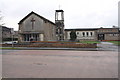
Queens Drive Methodist Church
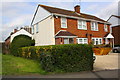
View across Whitbourne Avenue
Image: © Roger Templeman
Taken: 18 Mar 2011
0.10 miles
3
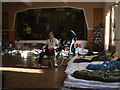
Christmas Care, Queen's Drive Methodist Church, Swindon
Christmas Care, a registered charity, provides temporary shelter for the homeless and lonely over the Christmas period. http://www.christmascare.co.uk/ Run by volunteers, and supported by local businesses, it opens its doors on Christmas Eve and serves hot meals (including a Christmas turkey dinner). This photograph shows the sleeping bags of the homeless people, while on the stage is the clothing donated by the people of Swindon.
Image: © Vieve Forward
Taken: 25 Dec 2013
0.11 miles
4
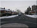
Kingswood Avenue from Whitbourne Avenue, Swindon
Image: © Nick Smith
Taken: 23 Dec 2010
0.12 miles
5
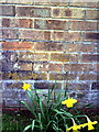
Benchmark on Queens Drive Methodist Church
The Ordnance Survey cut mark benchmark on Image is described on the Bench Mark Database at http://www.bench-marks.org.uk/bm37329
Image: © Roger Templeman
Taken: 18 Mar 2011
0.12 miles
6
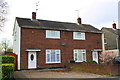
Nos. 34 and 32 Cranmore Avenue
There is an OS benchmark Image on the front of the left hand house, left of its front door.
Image: © Roger Templeman
Taken: 13 Apr 2015
0.13 miles
7
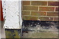
Benchmark on #34 Cranmore Avenue
Ordnance Survey cut mark benchmark described on the Bench Mark Database at http://www.bench-marks.org.uk/bm66084
Image: © Roger Templeman
Taken: 13 Apr 2015
0.13 miles
9
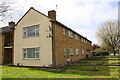
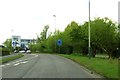
Apartments on Kingswood Avenue
There is an OS benchmark Image on the near corner of the block, right hand face, right of the downpipe
Image: © Roger Templeman
Taken: 13 Apr 2015
0.14 miles
10
Queen's Drive, Swindon
Churchfield's Academy is hiding behind the railings
Image: © David Howard
Taken: 9 Sep 2018
0.14 miles