
IMAGES TAKEN NEAR TO
Cranmore Avenue, SWINDON, SN3 2EJ
Introduction
This page details the photographs taken nearby to Cranmore Avenue, SN3 2EJ by members of the Geograph project.
The Geograph project started in 2005 with the aim of publishing, organising and preserving representative images for every square kilometre of Great Britain, Ireland and the Isle of Man.

There are currently over 7.5m images from over14,400 individuals and you can help contribute to the project by visiting https://www.geograph.org.uk
Image Map
Images are licensed for reuse under creativecommons.org/licenses/by-sa/2.0
Notes
- Clicking on the map will re-center to the selected point.
- The higher the marker number, the further away the image location is from the centre of the postcode.
Image Listing (61 Images Found)
Images are licensed for reuse under creativecommons.org/licenses/by-sa/2.0
Image
Details
Distance
1
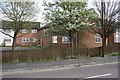
#127-129 Cranmore Avenue
There is an OS benchmark Image on the near corner of the building right of the grey downpipe
Image: © Roger Templeman
Taken: 13 Apr 2015
0.03 miles
2
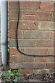
Benchmark on #127-129 Cranmore Avenue
Ordnance Survey cut mark benchmark described on the Bench Mark Database at http://www.bench-marks.org.uk/bm66086
Image: © Roger Templeman
Taken: 13 Apr 2015
0.03 miles
4
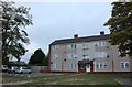
Flats on Cranmore Avenue, Swindon
The car park has been added since 2012
Image: © David Howard
Taken: 9 Sep 2018
0.09 miles
5
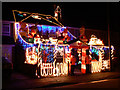
House at Yuletide, Cranmore Avenue, Swindon (2)
This shows the same house as this one but from a different angle Image Thanks to the householder for permission to take these photographs.
Image: © Brian Robert Marshall
Taken: 10 Dec 2009
0.11 miles
6
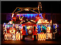
House at Yuletide, Cranmore Avenue, Swindon (1)
This house at this time of year is always a local feature. When I last photographed it two years ago the house next door was also illuminated Image For another angle please see Image Thanks to the householder for permission to take these photographs
Image: © Brian Robert Marshall
Taken: 10 Dec 2009
0.11 miles
7
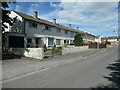
North side of Trentham Close, Park South
The houses are in a block of six.
Image: © Christine Johnstone
Taken: 14 Jul 2022
0.11 miles
8
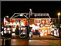
Cranmore Avenue, Swindon
These two houses are illuminated this way every Yuletide. The installation on the roof appears to be permanent; it can be seen on Google Earth.
Image: © Brian Robert Marshall
Taken: 8 Dec 2007
0.12 miles
9
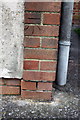
Benchmark on #171 Cranmore Avenue
Ordnance Survey cut mark benchmark described on the Bench Mark Database at http://www.bench-marks.org.uk/bm66087
Image: © Roger Templeman
Taken: 13 Apr 2015
0.13 miles
10
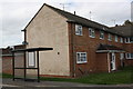
#171 Cranmore Avenue and bus stop shelter
There is an OS benchmark Image on the near corner of the house on the road face
Image: © Roger Templeman
Taken: 13 Apr 2015
0.13 miles