
IMAGES TAKEN NEAR TO
The Fairway, SWINDON, SN3 1RG
Introduction
This page details the photographs taken nearby to The Fairway, SN3 1RG by members of the Geograph project.
The Geograph project started in 2005 with the aim of publishing, organising and preserving representative images for every square kilometre of Great Britain, Ireland and the Isle of Man.

There are currently over 7.5m images from over14,400 individuals and you can help contribute to the project by visiting https://www.geograph.org.uk
Image Map
Images are licensed for reuse under creativecommons.org/licenses/by-sa/2.0
Notes
- Clicking on the map will re-center to the selected point.
- The higher the marker number, the further away the image location is from the centre of the postcode.
Image Listing (9 Images Found)
Images are licensed for reuse under creativecommons.org/licenses/by-sa/2.0
Image
Details
Distance
1
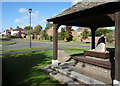
Seats around a Stone
This is beside Broome Manor Lane. A stone on a plinth with seating around it under a small shelter.
I don't know if it's anything special or just put there as an amenity.
Image: © Des Blenkinsopp
Taken: 10 Oct 2022
0.17 miles
2
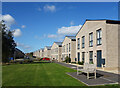
New Housing, Nevinson Road
A recent development in behind older housing along Broome Manor Lane.
Image: © Des Blenkinsopp
Taken: 10 Oct 2022
0.18 miles
3
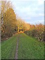
Path adjacent to Broome Manor Golf Course
The Council, who own this land, allow the public to use this footpath. Looking in the direction of Broome Manor Lane. See also Image and Image
Image: © P L Chadwick
Taken: 11 Dec 2008
0.22 miles
4
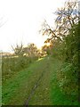
Path from Broome Manor Lane to Broome Manor Golf Complex
The local Council, who own the golf course, allow the public to use this path which runs alongside the course. This view is looking in the direction of the Club House.
Image: © P L Chadwick
Taken: 11 Dec 2008
0.23 miles
5
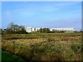
Wakefield House, Piper's Way, Swindon
Built in the early 1970s, this building was originally the UK headquarters of Burmah Oil. That company was taken over by BP some years ago and the building consequently renamed.
Image: © Brian Robert Marshall
Taken: 28 Dec 2006
0.25 miles
6
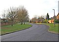
Broome Manor Lane
Broome Manor Lane is a road leading off Marlborough Road and eventually leads to the village of Hodson. The part nearest Marlborough Road was mainly built prior to World War II. Then around 30/40 years or so ago there was further building development along the road towards the back of Coate Water Countryside Park. This involved building houses in roads leading off the road, and providing wide grass verges and footpaths along most of the newly developed section. This view shows a typical stretch of the more recently developed part and is taken looking in the direction of Marlborough Road.
Image: © P L Chadwick
Taken: 11 Dec 2008
0.25 miles
7
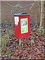
Dog waste bin in Broome Manor Lane
At a distance this could be mistaken for a postbox, but it is in fact a waste bin exclusively dedicated to dog waste. There are a lot of these dotted around the town. They are provided by the Council but emptied by a contractor.
Image: © P L Chadwick
Taken: 11 Dec 2008
0.25 miles
8
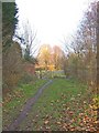
Path adjacent to Broome Manor golf course
The public are permitted to use this footpath which runs from Broome Manor Lane to the Broome Manor Golf Complex. It runs adjacent to the golf course and is much used by walkers with or without dogs. This view is looking towards the entrance gate on Broome Manor Lane.
Image: © P L Chadwick
Taken: 11 Dec 2008
0.25 miles
9
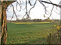
Broome Manor Golf Course
This view shows just a small section of Broome Manor Golf Course, which is owned by Swindon Borough Council, and is a very popular course. The course is part of what is called the Broome Manor Golf Complex and comprises both an 18 hole and a 9 hole course, a driving range, a clubhouse & other facilities.
http://www.bmgc.co.uk/indexpl.htm
Image: © P L Chadwick
Taken: 11 Dec 2008
0.25 miles