
IMAGES TAKEN NEAR TO
Carlton Gate, SWINDON, SN3 1NF
Introduction
This page details the photographs taken nearby to Carlton Gate, SN3 1NF by members of the Geograph project.
The Geograph project started in 2005 with the aim of publishing, organising and preserving representative images for every square kilometre of Great Britain, Ireland and the Isle of Man.

There are currently over 7.5m images from over14,400 individuals and you can help contribute to the project by visiting https://www.geograph.org.uk
Image Map
Images are licensed for reuse under creativecommons.org/licenses/by-sa/2.0
Notes
- Clicking on the map will re-center to the selected point.
- The higher the marker number, the further away the image location is from the centre of the postcode.
Image Listing (16 Images Found)
Images are licensed for reuse under creativecommons.org/licenses/by-sa/2.0
Image
Details
Distance
1
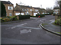
Houses in Carlton Gate, Broome Manor
Built in the 1960s-1970s, the houses in the various "Gates" off Broome Manor Lane were the most desirable in Swindon, and were handy for Broome Manor Golf Club.
Image: © Vieve Forward
Taken: 2 Jan 2013
0.04 miles
2
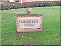
Carlton Gate road sign
Instead of using conventional metal name plates, the modern roads off Broome Manor Lane use rather attractive signs of which this is a typical example.
Image: © P L Chadwick
Taken: 11 Dec 2008
0.07 miles
3
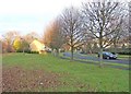
Carlton Gate
Carlton Gate is one of several fairly modern roads off Broome Manor Lane, which contain a lot of individually designed houses. Despite the word "Gate" in the road name, this is not a gated community, though there are two pillars standing on each side of the road, at the point where the houses begin. These can be seen in the far distance in this view. Just to the left of the house on the left, is an entrance to the Polo Ground. This large field is open to the public and is often used for fetes and other events, usually at Bank Holidays.
Image: © P L Chadwick
Taken: 11 Dec 2008
0.08 miles
4
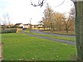
Broome Manor Lane
This view of part of the newer end of Broome Manor Road is looking in the direction of the back of Coate Water and Hodson. For the view in the other direction Image
Image: © P L Chadwick
Taken: 11 Dec 2008
0.09 miles
5
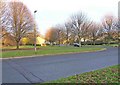
Junction of Broome Manor Lane and Carlton Gate
In the foreground is Broome Manor Lane. The road leading off is Carlton Gate. Most of the roads off Broome Manor Lane are called "Gate", although they are not actually gated communities. They do however have communal facilities, such as grassed areas, which are not maintained by the Council, so the residents pay a hefty service charge each year to meet the maintenance costs.
Image: © P L Chadwick
Taken: 11 Dec 2008
0.09 miles
6
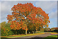
Broome Manor Lane
Display of autumnal colour in Swindon.
Image: © Wayland Smith
Taken: 27 Oct 2013
0.10 miles
7
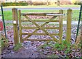
Gate from Broome Manor Lane to footpath adjacent to golf course
This gate gives access from Broome Manor Lane to the footpath which runs adjacent to the golf course and leads to the Clubhouse. What is different about this gate is that it has an unusual catch designed by The Kitch Catch Co. Ltd. who sponsor its use on this gate. This catch enables the gate to open in either direction by using just one finger. It is especially useful for people in wheelchairs and other people with restricted mobility.
Image: © P L Chadwick
Taken: 11 Dec 2008
0.11 miles
8
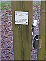
Kitch Catch on gate in Broome Manor Lane
The Kitch Catch Co. Ltd. sponsor the catch on this gate in Broome Manor Lane. It only needs a one finger operation to operate it. Image
Image: © P L Chadwick
Taken: 11 Dec 2008
0.11 miles
9
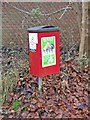
Dog waste bin in Broome Manor Lane
At a distance this could be mistaken for a postbox, but it is in fact a waste bin exclusively dedicated to dog waste. There are a lot of these dotted around the town. They are provided by the Council but emptied by a contractor.
Image: © P L Chadwick
Taken: 11 Dec 2008
0.12 miles
10
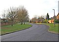
Broome Manor Lane
Broome Manor Lane is a road leading off Marlborough Road and eventually leads to the village of Hodson. The part nearest Marlborough Road was mainly built prior to World War II. Then around 30/40 years or so ago there was further building development along the road towards the back of Coate Water Countryside Park. This involved building houses in roads leading off the road, and providing wide grass verges and footpaths along most of the newly developed section. This view shows a typical stretch of the more recently developed part and is taken looking in the direction of Marlborough Road.
Image: © P L Chadwick
Taken: 11 Dec 2008
0.12 miles