
IMAGES TAKEN NEAR TO
Braemar Close, SWINDON, SN3 1HY
Introduction
This page details the photographs taken nearby to Braemar Close, SN3 1HY by members of the Geograph project.
The Geograph project started in 2005 with the aim of publishing, organising and preserving representative images for every square kilometre of Great Britain, Ireland and the Isle of Man.

There are currently over 7.5m images from over14,400 individuals and you can help contribute to the project by visiting https://www.geograph.org.uk
Image Map
Images are licensed for reuse under creativecommons.org/licenses/by-sa/2.0
Notes
- Clicking on the map will re-center to the selected point.
- The higher the marker number, the further away the image location is from the centre of the postcode.
Image Listing (27 Images Found)
Images are licensed for reuse under creativecommons.org/licenses/by-sa/2.0
Image
Details
Distance
3
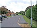
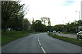
Guildford Avenue, Lawn
Taken from near the Lawn Medical Centre, this view shows the residential part of Guildford Avenue. Part of the road is only developed on one side and on the opposite is a very large grassed open area which can be partially seen in the far distance. This is typical of this estate which has many open areas, which have contributed to its popularity as an attractive part of the town in which to live.
Image: © P L Chadwick
Taken: 22 Aug 2008
0.13 miles
7
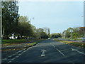
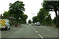
Queens Avenue, Swindon
A busy dual carriageway with a service road along this side for the houses.
Image: © Des Blenkinsopp
Taken: 10 Oct 2022
0.17 miles
8
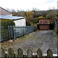
Thames Water enclosure, Lawn, Swindon
On the south side of Marlborough Road in the Lawn area of Swindon.
One map shows that the building is a pump house.
Image: © Jaggery
Taken: 14 Apr 2013
0.17 miles
10
#340 Marlborough Road with attached garage
There is an OS benchmark Image on the bricks on the right hand side of the garage door.
Image: © Roger Templeman
Taken: 22 Apr 2015
0.19 miles