
IMAGES TAKEN NEAR TO
Wheeler Avenue, SWINDON, SN2 7HL
Introduction
This page details the photographs taken nearby to Wheeler Avenue, SN2 7HL by members of the Geograph project.
The Geograph project started in 2005 with the aim of publishing, organising and preserving representative images for every square kilometre of Great Britain, Ireland and the Isle of Man.

There are currently over 7.5m images from over14,400 individuals and you can help contribute to the project by visiting https://www.geograph.org.uk
Image Map
Images are licensed for reuse under creativecommons.org/licenses/by-sa/2.0
Notes
- Clicking on the map will re-center to the selected point.
- The higher the marker number, the further away the image location is from the centre of the postcode.
Image Listing (21 Images Found)
Images are licensed for reuse under creativecommons.org/licenses/by-sa/2.0
Image
Details
Distance
2
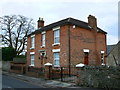
6 Green Road, Upper Stratton, Swindon
This is a double-fronted villa which is not, so far as I can see, of any great architectural merit. However, in days gone by it was part of a local dairy and it seems to have sentimental value. A planning application to demolish it has just been refused and an appeal lodged. It seemed a good idea to get a record of it in case the appeal succeeds....
...which it did resulting in this new development just over a year later Image
Image: © Brian Robert Marshall
Taken: 28 Jan 2007
0.15 miles
3
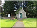
Cemetery Chapel at Upper Stratton
Viewed from the north-east.
Image: © Peter Wood
Taken: 1 Oct 2015
0.17 miles
4
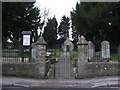
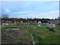
Green Road Cemetery
Green Road Cemetery is located opposite Upper Stratton Baptist Church in Green Road. It is owned by Stratton St. Margaret Parish Council and is for the interment of residents of the parish only.
http://www.strattonstmargaret.gov.uk/Services/Cemeteries.aspx
Image: © Vieve Forward
Taken: 8 Feb 2012
0.17 miles
5
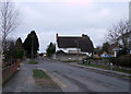
41 Green Road, Upper Stratton
No. 41 Green Road, Upper Stratton is a Grade II listed thatched cottage. It was probably built in the early 18th century, long before Stratton St. Margaret was urbanised by expansion of Swindon with the coming of the railway. http://www.britishlistedbuildings.co.uk/en-318559-41-stratton-st-margaret
Image: © Vieve Forward
Taken: 8 Feb 2012
0.18 miles
6
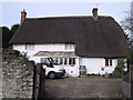
41 Green Road, Upper Stratton
No. 41 Green Road, Upper Stratton is a Grade II Listed thatched cottage. It was probably built in the early 18th century, long before Stratton St. Margaret was urbanised by expansion of Swindon with the coming of the railway. http://www.britishlistedbuildings.co.uk/en-318559-41-stratton-st-margaret
Image: © Vieve Forward
Taken: 14 Feb 2012
0.18 miles
8
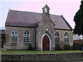
Upper Stratton Baptist Church, Green Road
Upper Stratton Baptist chapel was founded in 1861 and the Church formed in 1862. At first the building doubled as a school, as there was no school in the village at the time. In 1929 a Sunday School was built alongside the church. The church bell fell from use in 1886, and was later sent to Jamaica in response to an appeal from the Baptist Missionary Society. http://usbc.org.uk/ http://www.flickr.com/photos/swindonlocal/3925580699/ http://www.flickr.com/photos/swindonlocal/3925580705/in/photostream/
Image: © Vieve Forward
Taken: 14 Feb 2012
0.20 miles
9
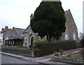
Upper Stratton Baptist Church, Green Road
Upper Stratton Baptist chapel was founded in 1861 and the Church formed in 1862. At first the building doubled as a school; the Sunday School (to the left of the picture) was added in 1929. http://usbc.org.uk/ http://www.flickr.com/photos/swindonlocal/3925580699/ http://www.flickr.com/photos/swindonlocal/3925580705/in/photostream/
Image: © Vieve Forward
Taken: 8 Feb 2012
0.20 miles
10
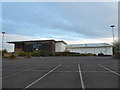
Derelict leisure centre, Kembrey Park
This David Lloyd Next Generation sports and fitness centre closed its doors in December 2017. The building now stands disused and derelict.
Image: © Vieve Forward
Taken: 8 Apr 2020
0.20 miles