
IMAGES TAKEN NEAR TO
Wheeler Avenue, SWINDON, SN2 7HH
Introduction
This page details the photographs taken nearby to Wheeler Avenue, SN2 7HH by members of the Geograph project.
The Geograph project started in 2005 with the aim of publishing, organising and preserving representative images for every square kilometre of Great Britain, Ireland and the Isle of Man.

There are currently over 7.5m images from over14,400 individuals and you can help contribute to the project by visiting https://www.geograph.org.uk
Image Map
Images are licensed for reuse under creativecommons.org/licenses/by-sa/2.0
Notes
- Clicking on the map will re-center to the selected point.
- The higher the marker number, the further away the image location is from the centre of the postcode.
Image Listing (30 Images Found)
Images are licensed for reuse under creativecommons.org/licenses/by-sa/2.0
Image
Details
Distance
1
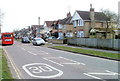
Headlands Grove, Swindon
Houses on the south side of the road, viewed from the corner of Cricklade Road (A4311). There are no houses on the north side of this section of Headlands Grove: it is the southern perimeter of the Swindon Academy site.
Image: © Jaggery
Taken: 12 Mar 2011
0.09 miles
2
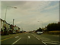
Cricklade Road in Stratton St Margaret
Image: © Andrew Abbott
Taken: 4 Sep 2010
0.10 miles
3
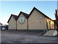
Crowdy's Hill School
Crowdy's Hill is a special school for children aged 5 to 19 with moderate learning difficulties or other complex needs. https://www.crowdyshill.swindon.sch.uk/
Image: © Vieve Forward
Taken: 4 Apr 2020
0.10 miles
5
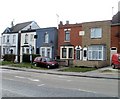
Flat-roofed houses, Cricklade Road, Swindon
Four flat-roofed houses located on Cricklade Road (A4311) between Headlands Grove and Wheeler Avenue.
Image: © Jaggery
Taken: 12 Mar 2011
0.15 miles
6
Co-operative Funeral Care, Cricklade Road
Image: © Vieve Forward
Taken: 8 Apr 2020
0.15 miles
8
North towards the A4311 Cricklade Road, Swindon
From the south, the unclassified Cricklade Road from the left joins the unnamed A4311 to become the A4311 Cricklade Road ahead.
Image: © Jaggery
Taken: 1 Dec 2014
0.16 miles
9
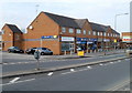
Cricklade Road shops, Swindon
The leftmost business, Eastcott Veterinary Clinic and Hospital, is on the corner of Chestnut Avenue. http://www.geograph.org.uk/photo/2324944
Image: © Jaggery
Taken: 12 Mar 2011
0.18 miles
10
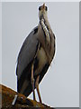
Heron on a suburban roof, Pinehurst
An unusual sight in the Swindon suburbs.
Image: © Vieve Forward
Taken: 1 Apr 2020
0.21 miles