
IMAGES TAKEN NEAR TO
The Ridge, SWINDON, SN26 7AS
Introduction
This page details the photographs taken nearby to The Ridge, SN26 7AS by members of the Geograph project.
The Geograph project started in 2005 with the aim of publishing, organising and preserving representative images for every square kilometre of Great Britain, Ireland and the Isle of Man.

There are currently over 7.5m images from over14,400 individuals and you can help contribute to the project by visiting https://www.geograph.org.uk
Image Map
Images are licensed for reuse under creativecommons.org/licenses/by-sa/2.0
Notes
- Clicking on the map will re-center to the selected point.
- The higher the marker number, the further away the image location is from the centre of the postcode.
Image Listing (21 Images Found)
Images are licensed for reuse under creativecommons.org/licenses/by-sa/2.0
Image
Details
Distance
1
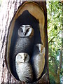
Owl carving by the entrance to Blunsdon House Hotel, Broad Blunsdon
Carved from the remains of a tree that stands in front of the hotel. It was killed when struck by lightning. There is a much larger carving of a single owl on the top of the trunk.
Image: © pam fray
Taken: 7 Aug 2015
0.03 miles
2
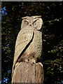
Owl carving at the entrance to Blunsdon House Hotel, Broad Blunsdon
Carved from the remains of a tree that stands in front of the hotel. It was killed when struck by lightning.
Image: © pam fray
Taken: 7 Aug 2015
0.04 miles
3
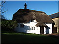
Thatched Cottage, Chapel Hill
One of the older houses in the village much of which nestles on the slope of the hill.
Image: © David Collins
Taken: 10 Jan 2007
0.06 miles
4
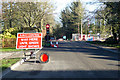
Road works on High Street, Broad Blunsdon
Towards the village centre.
Image: © Robin Webster
Taken: 19 Jan 2020
0.08 miles
6
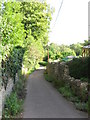
Looking down Chapel Hill, Blunsdon
The track is marked 'Unsuitable for motor vehicles'
Image: © Gareth James
Taken: 23 Aug 2009
0.09 miles
8
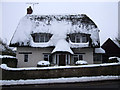
Thatched cottage, 47 High Street, Broad Blunsdon
Modernised and renovated 18th to early 19th century Grade II Listed thatched cottage. http://www.britishlistedbuildings.co.uk/en-318239-47-high-street-blunsdon-st-andrew-
Image: © Vieve Forward
Taken: 22 Jan 2013
0.10 miles
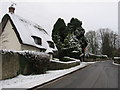
10
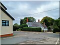
View from Heart in Hand car park, High Street, Blunsdon
Like many pubs nowadays, the pub is not always open. It's very popular when it is I've been told. This is the heart of old Blunsdon where several of the properties are 18th or early 19th century.
Image: © Brian Robert Marshall
Taken: 2 Oct 2024
0.12 miles