
IMAGES TAKEN NEAR TO
Shrewton Walk, SWINDON, SN2 5NE
Introduction
This page details the photographs taken nearby to Shrewton Walk, SN2 5NE by members of the Geograph project.
The Geograph project started in 2005 with the aim of publishing, organising and preserving representative images for every square kilometre of Great Britain, Ireland and the Isle of Man.

There are currently over 7.5m images from over14,400 individuals and you can help contribute to the project by visiting https://www.geograph.org.uk
Image Map
Images are licensed for reuse under creativecommons.org/licenses/by-sa/2.0
Notes
- Clicking on the map will re-center to the selected point.
- The higher the marker number, the further away the image location is from the centre of the postcode.
Image Listing (23 Images Found)
Images are licensed for reuse under creativecommons.org/licenses/by-sa/2.0
Image
Details
Distance
1
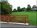
Aldbourne Close, Penhill, Swindon
The bridge providing the viewpoint is at the northern limit of the 1950s estate but is rather newer. The houses providing the title are those to the right. Out of shot to the left is the southern edge of the northern development area.
Image: © Brian Robert Marshall
Taken: 3 Oct 2008
0.03 miles
2
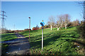
Footpath and Cycleway
Quite a lot of off-road routes for walkers and cyclists have been provided around here.
Image: © Des Blenkinsopp
Taken: 19 Jan 2020
0.04 miles
3
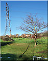
Pylon and Small Tree
Several strips of undeveloped land are to be found in this area. Possibly thought too steep to build on, they provide a bit of open space for local residents.
Image: © Des Blenkinsopp
Taken: 19 Jan 2020
0.05 miles
4
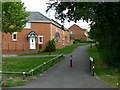
Glebe Close, Swindon
This is the interface between the 1950s housing estate of Penhill, out of shot to the right, and the 1990s northern development area.
Image: © Brian Robert Marshall
Taken: 3 Oct 2008
0.06 miles
5
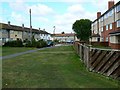
Staverton Way, Penhill, Swindon
Staverton Way leads north from Westwood Road. It contains a mix of terraced houses and maisonettes within a three-storey block, seen at the right. Penhill is typical of mid 20th century municipal housing estates to be found in many parts of the UK.
Image: © Brian Robert Marshall
Taken: 3 Oct 2008
0.09 miles
6
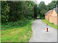
Foot and cycle path, near Glebe Close, Swindon
The path marks the southern edge of the northern development area of Swindon. This view is facing west.
Image: © Brian Robert Marshall
Taken: 3 Oct 2008
0.11 miles
7
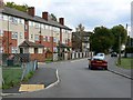
Westwood Road, Penhill, Swindon
The street-naming theme in Penhill is Wiltshire towns and villages. Westwood is a village near the county border with Bath and North-East Somerset. The three-storey block at the left contains quite roomy maisonettes. Penhill has benefited from a mid-life update carried out by the Council as can be seen from the external appearance of the block.
Image: © Brian Robert Marshall
Taken: 3 Oct 2008
0.12 miles
8
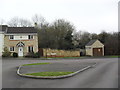
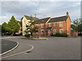
Gable Close
2000s houses in Abbey Mead.
Image: © Burgess Von Thunen
Taken: 29 Feb 2012
0.13 miles
10
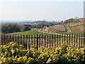
A view west from Thresher Drive, Groundwell, Swindon
The Groundwell residential area sits on rising land north of the established Penhill estate. In this west-facing view out of the square the cycle track enters the image at the right just about on the western gridline of this square.
Image: © Brian Robert Marshall
Taken: 16 Feb 2008
0.14 miles