IMAGES TAKEN NEAR TO
Winsley Close, SWINDON, SN2 5DY
Introduction
This page details the photographs taken nearby to Winsley Close, SN2 5DY by members of the Geograph project.
The Geograph project started in 2005 with the aim of publishing, organising and preserving representative images for every square kilometre of Great Britain, Ireland and the Isle of Man.

There are currently over 7.5m images from over14,400 individuals and you can help contribute to the project by visiting https://www.geograph.org.uk
Image Map
Images are licensed for reuse under creativecommons.org/licenses/by-sa/2.0
Notes
- Clicking on the map will re-center to the selected point.
- The higher the marker number, the further away the image location is from the centre of the postcode.
Image Listing (16 Images Found)
Images are licensed for reuse under creativecommons.org/licenses/by-sa/2.0
Image
Details
Distance
1
Winsley Close, Penhill, Swindon
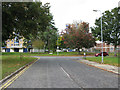
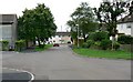
Penhill was the one of the first major post-war council housing estates in Swindon. The smaller estate of Moredon may have pre-dated it. Following Penhill, in the north of the town, the estates of Walcot, Park South and Park North, to the south, began in the mid 1950s. In terms of housing style the estates are indistinguishable, with various examples of system building types. In this view we are looking towards the southern edge of the square, marked by the position of the car on the left. The houses beyond are in Penhill Drive, the main road through the estate.
Image: © Brian Robert Marshall
Taken: 16 Jul 2008
0.05 miles
2
Penhill Library, Penhill Drive, Swindon
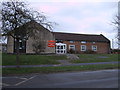
Penhill Library and Learning Centre, Penhill Drive, Swindon.
Image: © Vieve Forward
Taken: 18 Feb 2012
0.08 miles
3
New convenience store and houses, Penhill Drive, Penhill
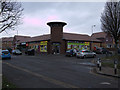
Braydon Court, a £5 million development in Penhill, finished in 2010, has replaced run down old houses and shops with this new convenience store, chip shop and 38 affordable homes.
Image: © Vieve Forward
Taken: 18 Feb 2012
0.10 miles
4
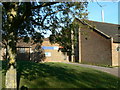
St Peter's Church Penhill
The church in now 50 years old; construction having started in 1955 it was opened on St Peter's Day (29 June) 1956.
Image: © Brian Robert Marshall
Taken: 4 Nov 2006
0.11 miles
5
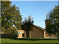
St Peter's Church Penhill
St. Peter's was designed by the architect, Oswald Breakspeare. Although the church is only 50 years old, the church bell dates from 1738.
Image: © Brian Robert Marshall
Taken: 4 Nov 2006
0.11 miles
6
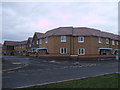
Braydon Court, Durrington Walk, Penhill
Braydon Court, a £5 million development in Penhill, was finished in 2010 and has replaced run down old houses and shops with 38 affordable homes, a new convenience store and a chip shop.
Image: © Vieve Forward
Taken: 18 Feb 2012
0.12 miles
7
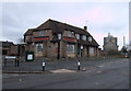
The Deer's Leap, Penhill Drive, Penhill
The Deer's Leap public house, Penhill Drive. Seagry Court block of flats is in the background.
Image: © Vieve Forward
Taken: 18 Feb 2012
0.13 miles
8
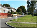
Stockton Road, Penhill, Swindon
Penhill is a local authority housing estate developed in the early to mid 1950s. Swindon Borough Council took advantage of the Town Development Act 1952 to expand at a rapid rate in the post-war years. Stockton Road heads up a slope from Inglesham Road in the southern part of the estate.
Image: © Brian Robert Marshall
Taken: 3 Oct 2008
0.16 miles
9
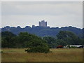
Cleverton Court, Penhill, Swindon
The title refers to the rather austere block of social housing on the skyline. It is about 8.5 kilometres from the viewpoint at RAF Blakehill nature reserve.
Image: © Brian Robert Marshall
Taken: 8 Jul 2020
0.19 miles