
IMAGES TAKEN NEAR TO
Tracy Close, SWINDON, SN25 4YS
Introduction
This page details the photographs taken nearby to Tracy Close, SN25 4YS by members of the Geograph project.
The Geograph project started in 2005 with the aim of publishing, organising and preserving representative images for every square kilometre of Great Britain, Ireland and the Isle of Man.

There are currently over 7.5m images from over14,400 individuals and you can help contribute to the project by visiting https://www.geograph.org.uk
Image Map
Images are licensed for reuse under creativecommons.org/licenses/by-sa/2.0
Notes
- Clicking on the map will re-center to the selected point.
- The higher the marker number, the further away the image location is from the centre of the postcode.
Image Listing (5 Images Found)
Images are licensed for reuse under creativecommons.org/licenses/by-sa/2.0
Image
Details
Distance
1
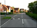
Elstree Way, Abbey Meads, Swindon
Abbey Meads is part of the very large Northern Development Area of Swindon. The area is bisected by a spine road called Thamesdown Drive which runs roughly north-east to south-west north of the established parts of Swindon. Development is taking place north and south of Thamesdown Drive. Elstree Way is south of it. The road leading off to the left is Wynwards Road.
Image: © Brian Robert Marshall
Taken: 13 May 2008
0.11 miles
3
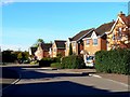
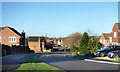
Oberon Way, Abbey Meads, Swindon
This pleasant suburban location is a crime scene. For some weeks cars parked hereabouts have been vandalised in an unusual fashion by having their anti-lock braking systems attacked. The perpetrators remained unidentified until recently when an off-duty police officer found teeth marks on the damaged parts of his car's brakes. Further forensic investigations confirmed that the offenders were of American extraction and members of the notorious Sciurus crime family http://www.swindonadvertiser.co.uk/news/8456675.Furry_vandal_drives_police_nuts/
Image: © Brian Robert Marshall
Taken: 17 Oct 2010
0.17 miles
4

Penhill Copse
A strip of woodland extending off the Seven Fields Nature Reserve. Possibly preserved as an environmental amenity, but more likely because it's on a slope too steep to build on.
Whatever the reason, it's a nice bit of green amongst all the houses.
Image: © Des Blenkinsopp
Taken: 19 Jan 2020
0.23 miles
5
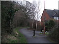
Footpath between Penhill Copse and Abbey Meads
Penhill Copse is the main wooded area of Seven Fields Nature Reserve, which was established in 1995. This small wood is situated between the Penhill and Abbey Meads housing estates.
Image: © Vieve Forward
Taken: 18 Feb 2012
0.24 miles