1
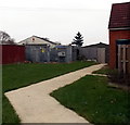
Tenzing Gardens
Off Hillary Close.
Image: © Vieve Forward
Taken: 21 Apr 2020
0.09 miles
2
Hazel Grove, Pinehurst, Swindon
Viewed from The Circle looking along Hazel Grove towards Whitworth Road.
This is a through route for walkers and cyclists but not for motor vehicles
because concrete posts block the far end of the road.
Image: © Jaggery
Taken: 1 Dec 2014
0.10 miles
3
Claremont Court, Whitworth Road
In the window is a notice thanking all at the Great Western Hospital for their service during the 2020 COVID-19 pandemic. Rainbows were displayed in many windows during the pandemic, many of them drawn by children, to thank NHS staff and other key workers for their service.
Image: © Vieve Forward
Taken: 23 Apr 2020
0.13 miles
4
Swindon : corner of Whitworth Road and Mendip Close
Viewed across Whitworth Road (B4006).
Image: © Jaggery
Taken: 12 Mar 2011
0.14 miles
5
Pinehurst Road towards Whitworth Road, Swindon
Viewed from near this http://www.geograph.org.uk/photo/4400264 derelict former library.
Image: © Jaggery
Taken: 1 Dec 2014
0.14 miles
6
The Circle electricity substation, Pinehurst, Swindon
The SSE Power Distribution electricity substation is opposite this http://www.geograph.org.uk/photo/4400264 derelict former library.
Image: © Jaggery
Taken: 1 Dec 2014
0.15 miles
7
North side of The Circle, Pinehurst, Swindon
The Circle is a 200 metre diameter area of houses in the Pinehurst district of Swindon.
Image: © Jaggery
Taken: 1 Dec 2014
0.15 miles
8
Swindon : corner of Whitworth Road and Crossways Avenue
Viewed across Whitworth Road (B4006).
Image: © Jaggery
Taken: 12 Mar 2011
0.15 miles
9
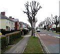
Pollarded trees, Pinehurst Road, Swindon
Pollarded trees give a somewhat eerie appearance to this suburban road.
Viewed from the corner of Whitworth Road.
Image: © Jaggery
Taken: 12 Mar 2011
0.16 miles
10
Hillary Close and adjoining park
Image: © Vieve Forward
Taken: 21 Apr 2020
0.16 miles


