IMAGES TAKEN NEAR TO
Lady Lane, SWINDON, SN25 2DN
Introduction
This page details the photographs taken nearby to Lady Lane, SN25 2DN by members of the Geograph project.
The Geograph project started in 2005 with the aim of publishing, organising and preserving representative images for every square kilometre of Great Britain, Ireland and the Isle of Man.

There are currently over 7.5m images from over14,400 individuals and you can help contribute to the project by visiting https://www.geograph.org.uk
Image Map
Images are licensed for reuse under creativecommons.org/licenses/by-sa/2.0
Notes
- Clicking on the map will re-center to the selected point.
- The higher the marker number, the further away the image location is from the centre of the postcode.
Image Listing (15 Images Found)
Images are licensed for reuse under creativecommons.org/licenses/by-sa/2.0
Image
Details
Distance
1
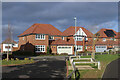
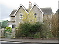
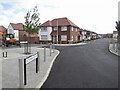
Jade Close
We have moved away from the architectural extravagance of some of the housing just a few blocks to the south.
A comfortable 1930s style retro is more the fashion here.
Jade Close is one of a number of local streets to have the name of a gemstone.
Image: © Des Blenkinsopp
Taken: 30 Jan 2023
0.04 miles
2
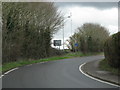
Bend before the Blunsdon roundabout
Image: © Sarah Charlesworth
Taken: 30 Mar 2010
0.04 miles
3
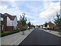
On Blunsdon Hill
Diamond Crescent in a newly built housing development.
Image: © Richard Webb
Taken: 31 Aug 2022
0.06 miles
4
Primary school, Blunsdon Hill
A newly built school.
Image: © Richard Webb
Taken: 31 Aug 2022
0.07 miles
6
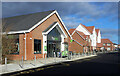
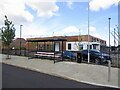
Co-op Store, Diamond Crescent
Only recently opened. Richard Webb's picture from 5 months ago Image shows contractors still finishing off the frontage.
Diamond Crescent is one of a number of nearby streets to have the name of a gemstone.
Image: © Des Blenkinsopp
Taken: 30 Jan 2023
0.08 miles
7
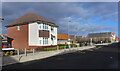
Diamond Crescent
The nearby streets have gemstone names as well.
Image: © Des Blenkinsopp
Taken: 30 Jan 2023
0.08 miles
8
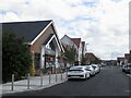
Co-op, Blunsdon Hill
Not yet open but very nearly completed.
Image: © Richard Webb
Taken: 31 Aug 2022
0.08 miles
9
Sapphire Road
A new housing development on a hill top.
Image: © Richard Webb
Taken: 31 Aug 2022
0.11 miles
10
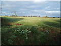
Fields north of Blunsdon
This grazing is at the very edge of the Swindon built up area and is now being further eroded just east of this photo as they are now building the Blunsdon bypass through the locality.
Image: © David Collins
Taken: 21 Feb 2007
0.16 miles