IMAGES TAKEN NEAR TO
Winterbourne Road, SWINDON, SN25 1PZ
Introduction
This page details the photographs taken nearby to Winterbourne Road, SN25 1PZ by members of the Geograph project.
The Geograph project started in 2005 with the aim of publishing, organising and preserving representative images for every square kilometre of Great Britain, Ireland and the Isle of Man.

There are currently over 7.5m images from over14,400 individuals and you can help contribute to the project by visiting https://www.geograph.org.uk
Image Map
Images are licensed for reuse under creativecommons.org/licenses/by-sa/2.0
Notes
- Clicking on the map will re-center to the selected point.
- The higher the marker number, the further away the image location is from the centre of the postcode.
Image Listing (11 Images Found)
Images are licensed for reuse under creativecommons.org/licenses/by-sa/2.0
Image
Details
Distance
3
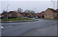
Westfield Way, Swindon
Westfield Way is a suburban road through north Swindon. It acts as a boundary between the area of the town developed in the 1970s and earlier to the left and newer development that started in the late 1980s and which is still ongoing.
Image: © Brian Robert Marshall
Taken: 29 Nov 2007
0.16 miles
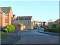
4
Crossing Torun Way
Torun Way is one of a group of adjacent streets all named after places or rivers in Poland.
Torun is an ancient city on the Vistula River famous for its Museum of Gingerbread. (Wikipedia)
Image: © Des Blenkinsopp
Taken: 30 Jan 2023
0.18 miles
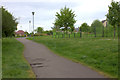
5
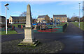
Small Obelisk in the Park
One of the small parks and play areas which have been created at intervals in among all the houses in this extensive new neighbourhood.
Not sure what the obelisk is about, it looks like it came from an old building.
Image: © Des Blenkinsopp
Taken: 30 Jan 2023
0.19 miles
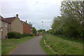
6
Rosemary Close, Haydon Wick
Most of the streets in the housing estates either side of Westfield Way are named after flowers, herbs and spices.
Image: © Vieve Forward
Taken: 18 Feb 2012
0.20 miles
7
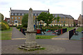
Haydon Wick recreation ground with obelisk
Image: © Robert Eva
Taken: 13 May 2017
0.20 miles
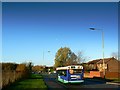
8
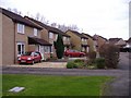
Rosemary Close
Part of an estate built at Haydon Wick in the 1990's.
Image: © Roger Cornfoot
Taken: 15 Jan 2007
0.21 miles
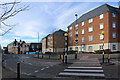
9
Capesthorne Drive, Haydon Wick
Modern housing in Greater Swindon.
Image: © Jonathan Billinger
Taken: 10 Dec 2009
0.21 miles
10
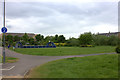
Haydon Wick recreation ground from Havisham Way
Image: © Robert Eva
Taken: 13 May 2017
0.21 miles