
IMAGES TAKEN NEAR TO
Thames Avenue, SWINDON, SN25 1PT
Introduction
This page details the photographs taken nearby to Thames Avenue, SN25 1PT by members of the Geograph project.
The Geograph project started in 2005 with the aim of publishing, organising and preserving representative images for every square kilometre of Great Britain, Ireland and the Isle of Man.

There are currently over 7.5m images from over14,400 individuals and you can help contribute to the project by visiting https://www.geograph.org.uk
Image Map
Images are licensed for reuse under creativecommons.org/licenses/by-sa/2.0
Notes
- Clicking on the map will re-center to the selected point.
- The higher the marker number, the further away the image location is from the centre of the postcode.
Image Listing (14 Images Found)
Images are licensed for reuse under creativecommons.org/licenses/by-sa/2.0
Image
Details
Distance
1
Deben Crescent, Haydon Wick, Swindon
Houses built c1970 viewed from Thames Avenue.
Image: © Jaggery
Taken: 12 Mar 2011
0.02 miles
2
Thames Avenue bungalows, Swindon
Bungalows on the north side of Thames Avenue, between Rother Close and Deben Crescent. Viewed from the corner of Tweed Close.
Image: © Jaggery
Taken: 12 Mar 2011
0.08 miles
3
Tweed Close, Haydon Wick, Swindon
Tweed Close houses built c1970, viewed from the corner of Thames Avenue.
Image: © Jaggery
Taken: 12 Mar 2011
0.08 miles
4
Corner of Severn Avenue and Thames Avenue, Haydon Wick, Swindon
Thames Avenue bungalows near the corner of Severn Avenue.
These street names are the nearest most of Swindon gets to a river. The River Ray http://www.geograph.org.uk/photo/1716191 flows past the western edge of the town. The River Thames is several kilometres north of the northern edge of Swindon.
Image: © Jaggery
Taken: 12 Mar 2011
0.12 miles
5
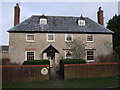
Haydon Wick Farmhouse, Pond Street, Haydon Wick
Grade II Listed former farmhouse, probably built in the 17th century, but altered in the mid-19th century. http://www.britishlistedbuildings.co.uk/en-318358-haydon-wick-farmhouse-haydon-wick
Image: © Vieve Forward
Taken: 18 Feb 2012
0.13 miles
6
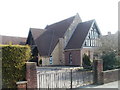
Emmanuel United Reformed Church, Haydon Wick
Modern building located at the eastern end of High Street. The church history can be traced back to 1849 (via many alterations), when a congregational chapel was built here. At that time, Haydon Wick was a hamlet to the north of Swindon.
Image: © Jaggery
Taken: 12 Mar 2011
0.14 miles
7
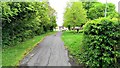
Blunsdon Road, Haydon Wick, Swindon
This stretch of ageing tarmac was once part of the original Blunsdon Road. The white lane divider is just about discernible. It has long been bypassed and the village of Haydon Wick was subsumed into greater Swindon decades ago.
Image: © Brian Robert Marshall
Taken: 27 Apr 2014
0.16 miles
8
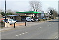
Greenmeadows Service Station, Swindon
Service station, MoTs, repairs and used cars bought and sold. Located on Thames Avenue, next door to the Shield & Dagger.
Image: © Jaggery
Taken: 12 Mar 2011
0.20 miles
9
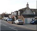
Blunsdon Road houses, Haydon Wick, Swindon
Houses on Blunsdon Road near the corner of High Street.
Now incorporated into Swindon, in the early decades of the 20th century Haydon Wick was a small hamlet. There were houses in the High Street area, and farms in the surrounding fields. Roads were little more than tracks. Mains gas was first available in 1930, and electricity not until 1939.
Image: © Jaggery
Taken: 12 Mar 2011
0.21 miles
10
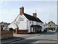
Fox and Hounds, Haydon Wick, Swindon
High Street pub. The building was described in an 1825 will as a "dwelling house with 8 acres of land".
It was first licensed to sell beer in 1830. When auctioned in 1875, it was described as "bar, taproom, cowstall and stable."
Image: © Jaggery
Taken: 12 Mar 2011
0.21 miles