1
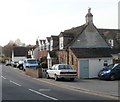
Emmanuel United Reformed Church, Haydon Wick
Modern building located at the eastern end of High Street. The church history can be traced back to 1849 (via many alterations), when a congregational chapel was built here. At that time, Haydon Wick was a hamlet to the north of Swindon.
Image: © Jaggery
Taken: 12 Mar 2011
0.06 miles
2
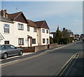
Corner of Severn Avenue and Thames Avenue, Haydon Wick, Swindon
Thames Avenue bungalows near the corner of Severn Avenue.
These street names are the nearest most of Swindon gets to a river. The River Ray http://www.geograph.org.uk/photo/1716191 flows past the western edge of the town. The River Thames is several kilometres north of the northern edge of Swindon.
Image: © Jaggery
Taken: 12 Mar 2011
0.08 miles
3
Greenmeadows Service Station, Swindon
Service station, MoTs, repairs and used cars bought and sold. Located on Thames Avenue, next door to the Shield & Dagger.
Image: © Jaggery
Taken: 12 Mar 2011
0.14 miles
4
Deben Crescent, Haydon Wick, Swindon
Houses built c1970 viewed from Thames Avenue.
Image: © Jaggery
Taken: 12 Mar 2011
0.16 miles
5
Thames Avenue bungalows, Swindon
Bungalows on the north side of Thames Avenue, between Rother Close and Deben Crescent. Viewed from the corner of Tweed Close.
Image: © Jaggery
Taken: 12 Mar 2011
0.17 miles
6
Tweed Close, Haydon Wick, Swindon
Tweed Close houses built c1970, viewed from the corner of Thames Avenue.
Image: © Jaggery
Taken: 12 Mar 2011
0.17 miles
7
Blunsdon Road houses, Haydon Wick, Swindon
Houses on Blunsdon Road near the corner of High Street.
Now incorporated into Swindon, in the early decades of the 20th century Haydon Wick was a small hamlet. There were houses in the High Street area, and farms in the surrounding fields. Roads were little more than tracks. Mains gas was first available in 1930, and electricity not until 1939.
Image: © Jaggery
Taken: 12 Mar 2011
0.20 miles
8
Fox and Hounds, Haydon Wick, Swindon
High Street pub. The building was described in an 1825 will as a "dwelling house with 8 acres of land".
It was first licensed to sell beer in 1830. When auctioned in 1875, it was described as "bar, taproom, cowstall and stable."
Image: © Jaggery
Taken: 12 Mar 2011
0.20 miles
9
Eastern section of High Street, Haydon Wick, Swindon
The view east at the corner of Blunsdon Road.
The large sign on the left shows that this section of High Street leads to Churchfield, Green Valley Avenue, Greenmeadow Avenue and Emmanuel U.R.C (United Reformed Church).
Image: © Jaggery
Taken: 12 Mar 2011
0.20 miles
10
Rose Cottage Nursing Home, Haydon Wick, Swindon
Located at 47 High Street, facing a street named Churchfield.
Privately-owned care home with nursing, for 18 residents.
Image: © Jaggery
Taken: 12 Mar 2011
0.20 miles


