
IMAGES TAKEN NEAR TO
Cayenne Park, SWINDON, SN2 2SF
Introduction
This page details the photographs taken nearby to Cayenne Park, SN2 2SF by members of the Geograph project.
The Geograph project started in 2005 with the aim of publishing, organising and preserving representative images for every square kilometre of Great Britain, Ireland and the Isle of Man.

There are currently over 7.5m images from over14,400 individuals and you can help contribute to the project by visiting https://www.geograph.org.uk
Image Map
Images are licensed for reuse under creativecommons.org/licenses/by-sa/2.0
Notes
- Clicking on the map will re-center to the selected point.
- The higher the marker number, the further away the image location is from the centre of the postcode.
Image Listing (24 Images Found)
Images are licensed for reuse under creativecommons.org/licenses/by-sa/2.0
Image
Details
Distance
1
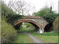
Former railway line near Mouldon Hill
A three-arch bridge over the route of the former Midland & South Western Junction Railway.
Image: © Gareth James
Taken: 14 Apr 2012
0.11 miles
2
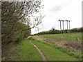
Former railway line near Mouldon Hill
On the route of the former Midland & South Western Junction Railway.
Image: © Gareth James
Taken: 14 Apr 2012
0.13 miles
3

Haydon Henge
Henge Stones off Thamesdown Drive, Swindon.
Image: © Wayland Smith
Taken: 13 Jun 2020
0.14 miles
4
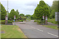
Entrance to Queen Elizabeth Drive and Ashdown Way
Image: © Robert Eva
Taken: 13 May 2017
0.14 miles
6
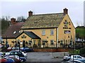
The Tawny Owl, Queen Elizabeth Drive, Swindon
This pub is only a few years old, like the rest of the Northern Development Area.
Image: © Brian Robert Marshall
Taken: 28 Jan 2007
0.15 miles
7
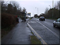
Westfield Way, approaching the Woodhall Park roundabout
Image: © Vieve Forward
Taken: 18 Feb 2012
0.16 miles
9
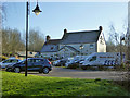
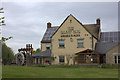
The Tawny Owl
Queen Elizabeth Drive, Swindon.
Image: © Robin Webster
Taken: 19 Jan 2020
0.16 miles
10
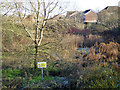
Area prone to flooding
So says the Environment Agency sign, and labels it Haydon Wick. This strictly was the name of a settlement some good way upstream along the brook that runs through this area and now drains a lot of the northern suburbs of Swindon.
Image: © Robin Webster
Taken: 19 Jan 2020
0.20 miles