
IMAGES TAKEN NEAR TO
Rodbourne Road, SWINDON, SN2 2AX
Introduction
This page details the photographs taken nearby to Rodbourne Road, SN2 2AX by members of the Geograph project.
The Geograph project started in 2005 with the aim of publishing, organising and preserving representative images for every square kilometre of Great Britain, Ireland and the Isle of Man.

There are currently over 7.5m images from over14,400 individuals and you can help contribute to the project by visiting https://www.geograph.org.uk
Image Map
Images are licensed for reuse under creativecommons.org/licenses/by-sa/2.0
Notes
- Clicking on the map will re-center to the selected point.
- The higher the marker number, the further away the image location is from the centre of the postcode.
Image Listing (199 Images Found)
Images are licensed for reuse under creativecommons.org/licenses/by-sa/2.0
Image
Details
Distance
1
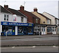
AEL Electrical & Lighting shop in Swindon
Viewed across Rodbourne Road. Adjacent businesses are My-T-Sharp barber shop and Swindon Mobility.
Image: © Jaggery
Taken: 15 Mar 2015
0.00 miles
2
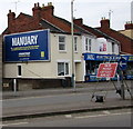
Manuary poster on a Swindon wall
Viewed across Rodbourne Road in March 2015. The CALM (Campaign Against Living Miserably) poster defines Manuary as the arbitrary month of the year within which everything will get better despite the lethargy, chill and lack of cash. This is a definition from #MANDICTIONARY, a project which aims to help men define themselves on their own terms. CALM is an organisation that exists to prevent male suicide in the UK.
The board is owned by JCDecaux, the largest outdoor advertising corporation in the world.
Image: © Jaggery
Taken: 15 Mar 2015
0.01 miles
3
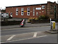
Rodbourne Methodist Church, Swindon
The Rodbourne Road church is part of the North Wiltshire Methodist Circuit, created in September 2014 from the union of the Swindon & Marlborough Circuit with the Chippenham Circuit.
Image: © Jaggery
Taken: 15 Mar 2015
0.01 miles
4
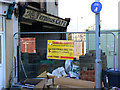
Terminus caf?, Rodbourne Road, Swindon
The café closed in 1969. It subsequently became a typewriter repair shop, which also closed some time ago. The building in which both businesses operated is now being comprehensively redeveloped. The sign seen here has been hidden from view for forty years and the refurbishment process has recently uncovered it. The name reveals a little of the history of the area. Once this was as far as the Swindon tram network reached giving rise to the appellation 'Terminus'. The tram system ran from 1904 until 1929 when buses took over the public transport rôle. Because there was a low bridge nearby under the Swindon to Gloucester railway, the bus route also ended here thus keeping alive the concept that the locality was a terminus. That changed in 1956 with the replacement of the original low bridge with a higher one underneath which buses could now pass. The café carried on however under its original name until it closed 13 years later. The details above are from the 'Swindonweb' site which also has a couple of interesting historical images of the area http://www.swindonweb.com/?m=8&s=116&ss=345&c=6640
Image: © Brian Robert Marshall
Taken: 17 Jan 2010
0.01 miles
5
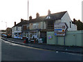
Shops, Rodbourne Road, Swindon
The small terrace of shops was built in 1925 according to local sources. The building undergoing refurbishment was once a café which closed in 1969. More information in the description to this submission Image
Image: © Brian Robert Marshall
Taken: 17 Jan 2010
0.01 miles
6
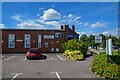
Swindon : Rodbourne Methodist Church
Looking towards Rodbourne Methodist Church.
Image: © Lewis Clarke
Taken: 14 Jul 2022
0.02 miles
7
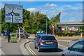
Swindon : Bruce Street Bridges Roundabout
Approaching the roundabout from Rodbourne Road.
Image: © Lewis Clarke
Taken: 14 Jul 2022
0.02 miles
8
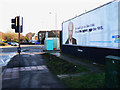
Bruce Street roundabout junction, Swindon
There is a fairly complex four-roundabout system at the junctions of Bruce Street, Kemble Drive, Rodbourne Road and Great Western Way. It was for many years a bottleneck largely because of the inadequate bridge under the Swindon to Gloucester railway. It is best seen from the aerial view afforded by Google Earth. The poster at the right can be seen in all its glory here Image
Image: © Brian Robert Marshall
Taken: 17 Jan 2010
0.02 miles
9
Roundabout work at the edge of the Bruce Street Bridges, Swindon
Viewed in March 2015, about halfway through the yearlong project to improve traffic flow through the major Bruce Street Bridges junction.
Image: © Jaggery
Taken: 15 Mar 2015
0.03 miles
10
Site of former Even Swindon School, Hughes Street, Swindon (6 of 7)
The gateway seen in this image from a few months ago Image has been blocked off while demolition of the old school is underway. More below..
Image: © Brian Robert Marshall
Taken: 19 Dec 2013
0.03 miles