
IMAGES TAKEN NEAR TO
Pinehurst Road, SWINDON, SN2 1SL
Introduction
This page details the photographs taken nearby to Pinehurst Road, SN2 1SL by members of the Geograph project.
The Geograph project started in 2005 with the aim of publishing, organising and preserving representative images for every square kilometre of Great Britain, Ireland and the Isle of Man.

There are currently over 7.5m images from over14,400 individuals and you can help contribute to the project by visiting https://www.geograph.org.uk
Image Map
Images are licensed for reuse under creativecommons.org/licenses/by-sa/2.0
Notes
- Clicking on the map will re-center to the selected point.
- The higher the marker number, the further away the image location is from the centre of the postcode.
Image Listing (79 Images Found)
Images are licensed for reuse under creativecommons.org/licenses/by-sa/2.0
Image
Details
Distance
1
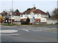
Swindon : corner of Whitworth Road and Crossways Avenue
Viewed across Whitworth Road (B4006).
Image: © Jaggery
Taken: 12 Mar 2011
0.02 miles
2
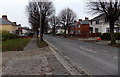
Pinehurst Road towards Whitworth Road, Swindon
Viewed from near this http://www.geograph.org.uk/photo/4400264 derelict former library.
Image: © Jaggery
Taken: 1 Dec 2014
0.02 miles
3
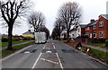
Pinehurst Road speed bumps, Swindon
Viewed from The Circle looking along Pinehurst Road towards Whitworth Road.
Image: © Jaggery
Taken: 1 Dec 2014
0.05 miles
4
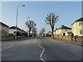
Newly pollarded trees, Pinehurst Road
Image: © Vieve Forward
Taken: 28 Mar 2020
0.05 miles
5
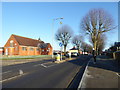
Disused former chapel, The Circle, Pinehurst
Former chapel, used consecutively as a library and shop, now boarded up, see Image The teenager on the pavement is riding an electric skateboard (also known as a Bluetooth smart electric self-balancing scooter/hover board/unicycle), which was the must-have Christmas present for teens in 2015.
Image: © Vieve Forward
Taken: 20 Jan 2016
0.05 miles
6
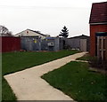
The Circle electricity substation, Pinehurst, Swindon
The SSE Power Distribution electricity substation is opposite this http://www.geograph.org.uk/photo/4400264 derelict former library.
Image: © Jaggery
Taken: 1 Dec 2014
0.05 miles
7
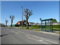
Pollarded trees, Pinehurst Road
Severely pollarded trees in Pinehurst road. Behind them are garages and an old chapel, now refurbished as a children's nursery.
Image: © Vieve Forward
Taken: 21 Apr 2020
0.06 miles
8
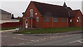
Derelict former library, Pinehurst, Swindon
Boarded up in December 2014, the building became redundant when a new library opened nearby. http://www.geograph.org.uk/photo/4265106
Image: © Jaggery
Taken: 1 Dec 2014
0.06 miles
9
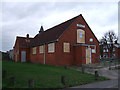
Former Library, The Circle, Pinehurst
This library relocated to the Pinetrees Community Centre, The Circle, Pinehurst, in December 2011.
Image: © Vieve Forward
Taken: 20 Jan 2012
0.06 miles
10
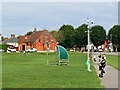
The Circle, Pinehurst, Swindon
The 'One Stop' shop seen here has been relocated temporarily as its original home is to be demolished Image The building in which it is housed was once the local library. Pinehurst was the first council estate of any size to be built in the years after the end of the Great War. Like other such areas there can be challenging behaviour on the part of a few residents. Note the presence of a CCTV camera cunningly disguised as a street light.
Image: © Brian Robert Marshall
Taken: 20 Aug 2013
0.06 miles