IMAGES TAKEN NEAR TO
Beech Avenue, SWINDON, SN2 1LN
Introduction
This page details the photographs taken nearby to Beech Avenue, SN2 1LN by members of the Geograph project.
The Geograph project started in 2005 with the aim of publishing, organising and preserving representative images for every square kilometre of Great Britain, Ireland and the Isle of Man.

There are currently over 7.5m images from over14,400 individuals and you can help contribute to the project by visiting https://www.geograph.org.uk
Image Map
Images are licensed for reuse under creativecommons.org/licenses/by-sa/2.0
Notes
- Clicking on the map will re-center to the selected point.
- The higher the marker number, the further away the image location is from the centre of the postcode.
Image Listing (35 Images Found)
Images are licensed for reuse under creativecommons.org/licenses/by-sa/2.0
Image
Details
Distance
1
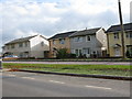
'Permanent' post war B.I.S.F houses on Beech Avenue
The image shows a row of permanent, steel framed British Iron & Steel Houses by British Steel Homes Ltd shortly after WWII. Wikipedia: https://en.wikipedia.org/wiki/BISF_house
Post-war shortages of labour and materials are reflected in some of the houses where non-traditional materials and methods of construction were employed. Extensive use was made of the Easiform House, designed and erected by Messrs. John Laing & Son, Ltd. and of the Airey House, both built substantially of concrete.
From: 'Swindon: Growth of the town', A History of the County of Wiltshire: Volume 9 (1970), pp. 104-119. URL: https://www.british-history.ac.uk/vch/wilts/vol9/pp104-119
Image: © Nick Smith
Taken: 28 Oct 2009
0.01 miles
2
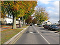
Looking east along Beech Avenue
Often used as a 'rat run', the extensive traffic calming additions have deterred many.
Image: © Nick Smith
Taken: 28 Oct 2009
0.01 miles
4
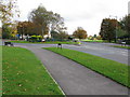
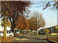
Roundabout at the eastern end of Akers Way
Image: © Nick Smith
Taken: 28 Oct 2009
0.09 miles
5
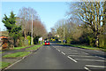
B4006 Vicarage Road, Rodbourne, Swindon
Looking north.
Image: © Robin Webster
Taken: 19 Jan 2020
0.10 miles