
IMAGES TAKEN NEAR TO
SWINDON, SN1 7NY
Introduction
This page details the photographs taken nearby to SN1 7NY by members of the Geograph project.
The Geograph project started in 2005 with the aim of publishing, organising and preserving representative images for every square kilometre of Great Britain, Ireland and the Isle of Man.

There are currently over 7.5m images from over14,400 individuals and you can help contribute to the project by visiting https://www.geograph.org.uk
Image Map
Images are licensed for reuse under creativecommons.org/licenses/by-sa/2.0
Notes
- Clicking on the map will re-center to the selected point.
- The higher the marker number, the further away the image location is from the centre of the postcode.
Image Listing (60 Images Found)
Images are licensed for reuse under creativecommons.org/licenses/by-sa/2.0
Image
Details
Distance
1
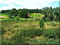
Across the River Ray to Westlecott Farm Cottages, Swindon
The river is little more than a small stream at this location although it does its bit to fill the River Thames eventually. For now it's hidden in the undergrowth. The redbrick cottages in the distance are all that's left of the eponymous farm demolished a few years ago.
Image: © Brian Robert Marshall
Taken: 29 Jul 2014
0.01 miles
2
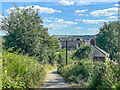
Path to East Wichel
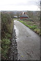
Bridleway giving access to the early 2000s development of East Wichel from Mill Lane (and therefore Old Town) and the Old Town Railway Path. On the right are Westlecott Farm Cottages.
Image: © Ian Capper
Taken: 14 Jul 2022
0.01 miles
3
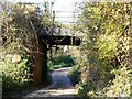
Railway overbridge on the old MSW & JR railway
Many of these overbridges were demolished after closure of the railway in 1961. This one survives to preserve the continuity of the old trackbed, which is now used by cyclists and pedestrians.
Image: © Brian Robert Marshall
Taken: 18 Nov 2006
0.01 miles
4
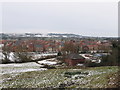
Looking towards Wichelstowe
View from the former MSWJ railway line / current cycle path, towards the new development of Wichelstowe, on Swindon's 'front garden'. The house in the foreground is on the lane that led to Westlecot Farm.
Image: © Gareth James
Taken: 27 Dec 2010
0.02 miles
5
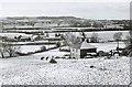
Westlecott Farm & the "front garden" in winter, Swindon
Other pictures in this square show the fate of Westlecott Farm, but when this picture was taken some years ago, it was still a working farm. The house in the foreground faced onto the private road, which led off Mill Lane and down to the farm. Opposite the house can be seen a figure; possibly they are feeding the two horses standing in the snow covered field. Sadly this is a view which has now gone forever, as work proceeds on the development of this area. Image
Image: © P L Chadwick
Taken: Unknown
0.03 miles
7
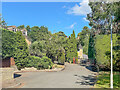
Mill Lane
Short side stub off Mill Lane.
Image: © Ian Capper
Taken: 14 Jul 2022
0.08 miles
8
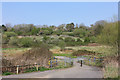
Wichelstowe Footbridge
Bridge heading towards the old railway path.
Image: © Wayland Smith
Taken: 10 Apr 2020
0.09 miles
9
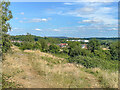
Towards Homeleaze
Looking across open grassland to Homeleaze, a development off Croft Road, completed in 2021. In the background is Nationwide House, the headquarters of the Nationwide Building Society.
Image: © Ian Capper
Taken: 14 Jul 2022
0.09 miles
10
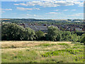
East Wichel
Looking down to the early 2000s development of East Wichel from by the Old Town Railway Path.
Image: © Ian Capper
Taken: 14 Jul 2022
0.10 miles