
IMAGES TAKEN NEAR TO
Letcombe Lane, SN1 7DW
Introduction
This page details the photographs taken nearby to Letcombe Lane, SN1 7DW by members of the Geograph project.
The Geograph project started in 2005 with the aim of publishing, organising and preserving representative images for every square kilometre of Great Britain, Ireland and the Isle of Man.

There are currently over 7.5m images from over14,400 individuals and you can help contribute to the project by visiting https://www.geograph.org.uk
Image Map
Images are licensed for reuse under creativecommons.org/licenses/by-sa/2.0
Notes
- Clicking on the map will re-center to the selected point.
- The higher the marker number, the further away the image location is from the centre of the postcode.
Image Listing (74 Images Found)
Images are licensed for reuse under creativecommons.org/licenses/by-sa/2.0
Image
Details
Distance
1
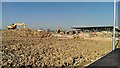
Construction plant, Mill Lane, Swindon
At the right is the almost-completed Waitrose supermarket scheduled to open in April 2014. Quite a bit of landscaping remains to be done.
Image: © Brian Robert Marshall
Taken: 9 Mar 2014
0.04 miles
2
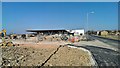
New supermarket, Mill Lane, Swindon
The supermarket is being developed for Waitrose, the food retailing arm of the John Lewis Partnership. It is scheduled to open in a month's time.
Image: © Brian Robert Marshall
Taken: 9 Mar 2014
0.06 miles
3
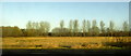
Trees near West Leaze
Seen from the M4.
Image: © Derek Harper
Taken: 19 Jan 2018
0.06 miles
4
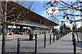
In front of Waitrose
A new supermarket in the new Wichelstowe community on the edge of Swindon.
Image: © Des Blenkinsopp
Taken: 17 Oct 2022
0.07 miles
5
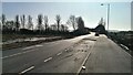
Mill Lane, Swindon
This part of the lane has been remodelled as part of the development of a significant new Waitrose supermarket behind the viewpoint. It carries traffic over the M4 motorway marked by the line of trees.
Image: © Brian Robert Marshall
Taken: 9 Mar 2014
0.07 miles
6
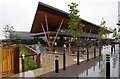
Waitrose, Mill Lane, Wichelstowe, Swindon
This rather futuristic looking building is Swindon's first Waitrose supermarket, which opened in April 2014. Built on former farmland, it is at the moment almost in the middle of nowhere. But the mainly residential area known as Wichelstowe continues to be developed and before long the building will be adjacent to large numbers of houses. On the building's west side is an attractively restored section of the long closed Wilts & Berks Canal. Wichelstowe seems to be the general name given to the land between the old railway line skirting Swindon's Old Town and the M4 motorway. It used to be described as Swindon's front garden and the Borough Council years ago promised it would never be built on. A policy which was soon reversed.
Image: © P L Chadwick
Taken: 23 Aug 2015
0.08 miles
7
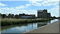
Development management office, Wichelstowe
Overseeing the growth of 'a brand new community to live life as you've always wanted'.
Image: © Christine Johnstone
Taken: 14 Jul 2022
0.10 miles
8
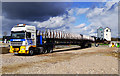
Truck with bridge, Wichelstowe, Swindon
The bridge is intended to cross the Wilts & Berks Canal and connect Waitrose & Partners supermarket Image with the recently-opened H&W (Hall & Woodhouse) restaurant visible to the right of the end of the bridge. The bridge was delivered a week ago but unfortunately prolonged spells of high wind have prevented it being removed from the truckbed and lowered into place. Quite a good story about the bridge project on the local paper's website https://www.swindonadvertiser.co.uk/news/17490584.for-me-its-straightforward-says-driver-of-truck-that-bore-giant-wichelstowe-canal-bridge/
Image: © Brian Robert Marshall
Taken: 17 Mar 2019
0.10 miles
9
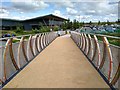
View south-east along Wichelstowe bridge, Swindon
The bridge installed back in March this year is now open. It crosses a restored section of the Wilts and Berks canal and connects a Waitrose store and a pub/restaurant.
Image: © Brian Robert Marshall
Taken: 7 Aug 2019
0.10 miles
10
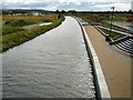
View south-west from Wichelstowe bridge, Swindon
This section is back in water a year on from this photo Image The section terminates about 200 metres away in the direction of view. It isn't in water again until about 4.85 kilometres west at this point Image There are major obstacles to the stretch in between ever being connected not least being the existence of the M4 motorway 220 metres or so further on from the end of the section.
Image: © Brian Robert Marshall
Taken: 7 Aug 2019
0.11 miles