
IMAGES TAKEN NEAR TO
Beckett Strand, SN1 7DG
Introduction
This page details the photographs taken nearby to Beckett Strand, SN1 7DG by members of the Geograph project.
The Geograph project started in 2005 with the aim of publishing, organising and preserving representative images for every square kilometre of Great Britain, Ireland and the Isle of Man.

There are currently over 7.5m images from over14,400 individuals and you can help contribute to the project by visiting https://www.geograph.org.uk
Image Map
Images are licensed for reuse under creativecommons.org/licenses/by-sa/2.0
Notes
- Clicking on the map will re-center to the selected point.
- The higher the marker number, the further away the image location is from the centre of the postcode.
Image Listing (70 Images Found)
Images are licensed for reuse under creativecommons.org/licenses/by-sa/2.0
Image
Details
Distance
1
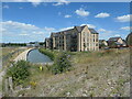
Wilts & Berks canal, Wichelstowe
Heading north from an earth bund. Barratt's show homes on Danby Strand and Beckett Strand are alongside.
Image: © Christine Johnstone
Taken: 14 Jul 2022
0.03 miles
2
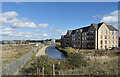
The end of the restoration
The restored section of the old Wilts & Berks canal stops here at the end of the new housing.
Abandoned over 100 years ago, the canal has been brought back from dereliction as a water feature at the heart of a new development.
Will it continue as building progresses? Will it ever connect to the rest of the canal system?
It's worth noting that the roadway where I'm standing is on an embankment high enough for the canal to go underneath at some future date.
The M4 a bit further along might be more of a problem.
Image: © Des Blenkinsopp
Taken: 17 Oct 2022
0.03 miles
3
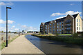
New Canalside Apartments
Housing by the newly restored Wilts & Berks Canal.
Land all around is being prepared for more building, so this open space look may not be permanent.
Image: © Des Blenkinsopp
Taken: 17 Oct 2022
0.04 miles
4
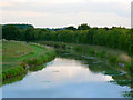
A closer view of the Wilts and Berks canal, Mill Lane, Swindon
This is a companion to this image http://www.geograph.org.uk/photo/1362014 mainly to show that, although technically this is a disused canal, at least one person finds it useful for angling purposes. This and the other photos of the canal taken this day were done so a bit late in the evening and the light was fading.
Image: © Brian Robert Marshall
Taken: 19 Jun 2009
0.04 miles
5
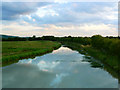
Wilts and Berks canal, Mill Lane, Swindon
You'll search in vain for this canal on the 1:50K map and, although the 1:25K map acknowledges its existence as a 'Canal (dis)', neither map shows the bridge I was standing on. The bridge isn't on the aerials either.
Image: © Brian Robert Marshall
Taken: 19 Jun 2009
0.04 miles
6
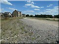
New road, Wichelstowe
Used for construction vehicles and plant now, but probably destined to be a public road eventually.
Image: © Christine Johnstone
Taken: 14 Jul 2022
0.04 miles
7

Construction site, central Wichelstowe
For more houses, or more amenities?
Image: © Christine Johnstone
Taken: 14 Jul 2022
0.05 miles
8
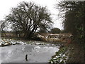
Wilts & Berks Canal, Swindon
The end of the restored section, with the unrestored route beyond.
Image: © Gareth James
Taken: 27 Dec 2010
0.05 miles
9
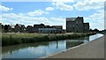
Development management office, Wichelstowe
Overseeing the growth of 'a brand new community to live life as you've always wanted'.
Image: © Christine Johnstone
Taken: 14 Jul 2022
0.06 miles
10

Start of Wilts & Berks Canal
One end of the restored section of canal near Swindon.
Image: © Gareth James
Taken: 27 Dec 2010
0.06 miles