IMAGES TAKEN NEAR TO
Wheatsheaf Lane, MALMESBURY, SN16 9TB
Introduction
This page details the photographs taken nearby to Wheatsheaf Lane, SN16 9TB by members of the Geograph project.
The Geograph project started in 2005 with the aim of publishing, organising and preserving representative images for every square kilometre of Great Britain, Ireland and the Isle of Man.

There are currently over 7.5m images from over14,400 individuals and you can help contribute to the project by visiting https://www.geograph.org.uk
Image Map
Images are licensed for reuse under creativecommons.org/licenses/by-sa/2.0
Notes
- Clicking on the map will re-center to the selected point.
- The higher the marker number, the further away the image location is from the centre of the postcode.
Image Listing (85 Images Found)
Images are licensed for reuse under creativecommons.org/licenses/by-sa/2.0
Image
Details
Distance
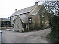
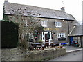
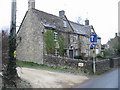
3
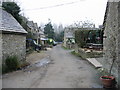
View along Wheatsheaf Lane
The Wheatsheaf Inn is on the right
Image: © Nick Smith
Taken: 4 Jan 2009
0.02 miles
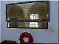
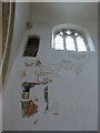
5
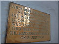
All Saints, Oaksey: memorial (2)
The Bishop of Bristol at that time was Oliver Tomkins https://en.wikipedia.org/wiki/Oliver_Tomkins
Image: © Basher Eyre
Taken: 19 Jul 2014
0.06 miles