
IMAGES TAKEN NEAR TO
Crudwell Road, MALMESBURY, SN16 9RU
Introduction
This page details the photographs taken nearby to Crudwell Road, SN16 9RU by members of the Geograph project.
The Geograph project started in 2005 with the aim of publishing, organising and preserving representative images for every square kilometre of Great Britain, Ireland and the Isle of Man.

There are currently over 7.5m images from over14,400 individuals and you can help contribute to the project by visiting https://www.geograph.org.uk
Image Map
Images are licensed for reuse under creativecommons.org/licenses/by-sa/2.0
Notes
- Clicking on the map will re-center to the selected point.
- The higher the marker number, the further away the image location is from the centre of the postcode.
Image Listing (13 Images Found)
Images are licensed for reuse under creativecommons.org/licenses/by-sa/2.0
Image
Details
Distance
2
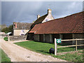
Home Farmhouse, Charlton Park Estate
Home Farm is part of the Charlton Park Estate. Note the round pillars of the former agricultural outbuilding, which are typical in this area.
Image: © Vieve Forward
Taken: 21 Apr 2012
0.03 miles
4
Home farm, Charlton Park
Part of an extensive former estate, situated next to the A429.
Image: © Roger Cornfoot
Taken: 16 Jan 2007
0.05 miles
5
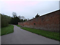
Garden wall, Charlton Park Estate
This Grade II listed red brick wall, 3 metres in height, indicates the size of the kitchen gardens at Charlton Park Estate. Capability Brown, who was at Charlton in 1768, proposed alterations to the house which were not accepted, and drew sketches for water near the house and for a kitchen garden and offices. The walled kitchen gardens at the west edge of the park in 1773 were probably by Brown. The kitchen garden was a flower garden in the earlier 20th century. http://www.british-history.ac.uk/report.aspx?compid=116140 http://www.britishlistedbuildings.co.uk/en-315647-garden-flat-and-former-kitchen-garden-wa
Image: © Vieve Forward
Taken: 22 Apr 2012
0.10 miles
6

Crudwell Road south of Home Farm
The A429 about 2 km northeast of Malmesbury.
Image: © Derek Harper
Taken: 12 May 2026
0.11 miles
7

Tree in hedge by A429
Looking left from the stretch of road shown in Image
Image: © Derek Harper
Taken: 12 May 2026
0.12 miles
8
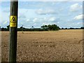
Electricity poles and a field of wheat, Griffin Barns Farm
The low voltage power lines lead away to the north across a wheat crop that will probably be harvested in the next few days.
Image: © Brian Robert Marshall
Taken: 8 Aug 2008
0.13 miles
9
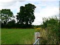
Field margin near the A429 north of Malmesbury
The A429 is out of shot to the right of the hedge. The field is only a small one probably used as grazing land.
Image: © Brian Robert Marshall
Taken: 8 Aug 2008
0.16 miles
10
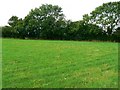
Part of a small field north of Malmesbury
This is a view facing west-north-west. The total area of the field is about 7600 m2 (0.76 hectares, 1.9 acres) and is not large enough for a cereal crop. It is probably used as pasture.
Image: © Brian Robert Marshall
Taken: 8 Aug 2008
0.18 miles