
IMAGES TAKEN NEAR TO
Minety, MALMESBURY, SN16 9PN
Introduction
This page details the photographs taken nearby to SN16 9PN by members of the Geograph project.
The Geograph project started in 2005 with the aim of publishing, organising and preserving representative images for every square kilometre of Great Britain, Ireland and the Isle of Man.

There are currently over 7.5m images from over14,400 individuals and you can help contribute to the project by visiting https://www.geograph.org.uk
Image Map
Images are licensed for reuse under creativecommons.org/licenses/by-sa/2.0
Notes
- Clicking on the map will re-center to the selected point.
- The higher the marker number, the further away the image location is from the centre of the postcode.
Image Listing (11 Images Found)
Images are licensed for reuse under creativecommons.org/licenses/by-sa/2.0
Image
Details
Distance
1
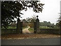
The approach to Minety Park
The maps have 'Minety House', but I have to assume that the people who live there (and presumably put the name on the gate) know what it is called!
Image: © David Purchase
Taken: 1 Nov 2016
0.07 miles
2
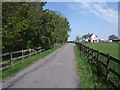
Drive to Home Farm
This drive is also a public bridleway. There are two substantial semi-detached houses in the distance on the right, and a pink-flowering horse chestnut on the left. The drive leads to Home Farm and Home Farm Business Centre. The name of the farm indicates that it once provided food and income for nearby Minety House.
Image: © Vieve Forward
Taken: 17 May 2014
0.12 miles
3
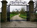
Gateway to Minety Park, Minety
The gateway has been moved since the last time it was photographed.
Image: © Brian Robert Marshall
Taken: 4 Apr 2011
0.13 miles
4
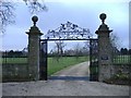
Minety Park
The house is just visible, through the gates, at the end of the drive.
Image: © Roger Cornfoot
Taken: 29 Jan 2007
0.13 miles
5
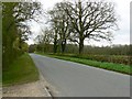
The road past Minety Park towards Minety
The entrance to Minety Park provides a convenient pull-in to grab a quick snap of a well-maintained minor road in north Wiltshire.
Image: © Brian Robert Marshall
Taken: 4 Apr 2011
0.16 miles
6
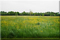
Field near Upper Minety
Formerly used for grazing, this field is now fallow.
Image: © Bill Boaden
Taken: 26 May 2018
0.18 miles
7
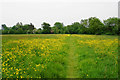
Footpath through buttercups
The path leaves Upper Minety in the direction of Minety.
Image: © Bill Boaden
Taken: 26 May 2018
0.21 miles
8
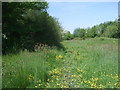
Bridleway, Upper Minety
This public bridleway connects a drive at the back of Minety House to Crossling Lane, Upper Minety. It is extremely soggy and churned up by horses' hooves, and just east of here, I had to take my boots off and paddle across a muddy rivulet.
Image: © Vieve Forward
Taken: 17 May 2014
0.21 miles
9
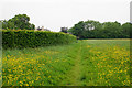
Path to Upper Minety
St Leonard's Church can be seen ahead. The land behind the hedge to the left used to be part of this field, but has been taken into what I presume is a garden extension.
Image: © Bill Boaden
Taken: 26 May 2018
0.22 miles
10
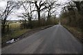
Road to Upper Minety
Road to Upper Minety from Minety.
Image: © Philip Halling
Taken: 17 Mar 2018
0.23 miles