IMAGES TAKEN NEAR TO
Meadow Close, MALMESBURY, SN16 9FT
Introduction
This page details the photographs taken nearby to Meadow Close, SN16 9FT by members of the Geograph project.
The Geograph project started in 2005 with the aim of publishing, organising and preserving representative images for every square kilometre of Great Britain, Ireland and the Isle of Man.

There are currently over 7.5m images from over14,400 individuals and you can help contribute to the project by visiting https://www.geograph.org.uk
Image Map
Images are licensed for reuse under creativecommons.org/licenses/by-sa/2.0
Notes
- Clicking on the map will re-center to the selected point.
- The higher the marker number, the further away the image location is from the centre of the postcode.
Image Listing (59 Images Found)
Images are licensed for reuse under creativecommons.org/licenses/by-sa/2.0
Image
Details
Distance
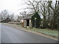
5
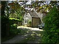
The Old Toll House, Upper Minety
At the corner of Flisteridge Road, Crossing Lane and Hanbury Hill. There would not appear to have been any milestones along Flisteridge, so that turnpike may have been associated with a private estate.
The Toll Gate appears on the David Rumsey 1858 map.
Milestone Society National ID: WI.MIN2
Image: © Mr Red
Taken: 25 May 2023
0.06 miles
6
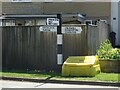
Fingerpost, Upper Minety
At the junction of Hornbury Hill, Flisteridge Road and Crossings Lane.
Flistergate (right) was a toll gate in the 18ᵗʰ C.
Opposite Image
Inscription: Cricklade / Purton // Somerford Keynes / Oaksey / Minety Church // Crudwell / Hankerton / Charlton
Milestone Society National ID: WI_SU0090
Image: © Mr Red
Taken: 25 May 2023
0.06 miles
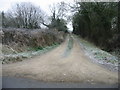
9
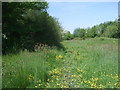
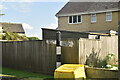
Bridleway, Upper Minety
This public bridleway connects a drive at the back of Minety House to Crossling Lane, Upper Minety. It is extremely soggy and churned up by horses' hooves, and just east of here, I had to take my boots off and paddle across a muddy rivulet.
Image: © Vieve Forward
Taken: 17 May 2014
0.07 miles
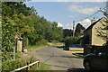
10
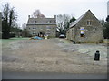
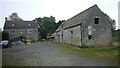
The Old Inn, Upper Minety
Now the former Old Inn, another pub closed and converted.
Image: © Nick Smith
Taken: 4 Jan 2009
0.07 miles