IMAGES TAKEN NEAR TO
Pinkney, MALMESBURY, SN16 0NZ
Introduction
This page details the photographs taken nearby to SN16 0NZ by members of the Geograph project.
The Geograph project started in 2005 with the aim of publishing, organising and preserving representative images for every square kilometre of Great Britain, Ireland and the Isle of Man.

There are currently over 7.5m images from over14,400 individuals and you can help contribute to the project by visiting https://www.geograph.org.uk
Image Map
Images are licensed for reuse under creativecommons.org/licenses/by-sa/2.0
Notes
- Clicking on the map will re-center to the selected point.
- The higher the marker number, the further away the image location is from the centre of the postcode.
Image Listing (16 Images Found)
Images are licensed for reuse under creativecommons.org/licenses/by-sa/2.0
Image
Details
Distance
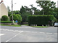
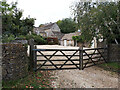
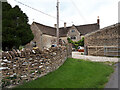
2
A well concealed phone box
Can you spot it? The hedge to the left of the black gates has been cut away to give access to this old-style telephone box, apparently still in working order.
Image: © HelenK
Taken: 1 Jan 2015
0.02 miles
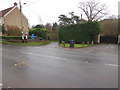
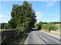
3
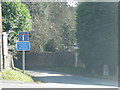
Road unsuitable for long vehicles
Image: © Sarah Charlesworth
Taken: 4 Mar 2010
0.03 miles
5
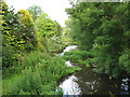
The River Avon at Pinkney
This view is looking downstream from the bridge.
Image: © David Purchase
Taken: 1 Jul 2011
0.08 miles
8
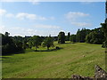
Grazing, Pinkney Park
The valley of the River Avon.
Image: © JThomas
Taken: 14 Jul 2019
0.12 miles
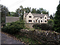
10
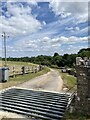
Cattle grid on driveway to Pinkney Mill
Image: © Alan Hughes
Taken: 13 Jul 2022
0.15 miles