IMAGES TAKEN NEAR TO
Norton, MALMESBURY, SN16 0JY
Introduction
This page details the photographs taken nearby to SN16 0JY by members of the Geograph project.
The Geograph project started in 2005 with the aim of publishing, organising and preserving representative images for every square kilometre of Great Britain, Ireland and the Isle of Man.

There are currently over 7.5m images from over14,400 individuals and you can help contribute to the project by visiting https://www.geograph.org.uk
Image Map
Images are licensed for reuse under creativecommons.org/licenses/by-sa/2.0
Notes
- Clicking on the map will re-center to the selected point.
- The higher the marker number, the further away the image location is from the centre of the postcode.
Image Listing (13 Images Found)
Images are licensed for reuse under creativecommons.org/licenses/by-sa/2.0
Image
Details
Distance
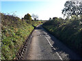
1
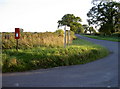
Post box on a pole
The local area is mainly farmland, and so the people find this stand-alone box handily placed at a junction.
Image: © Neil Owen
Taken: 30 Aug 2010
0.12 miles
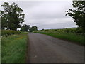
2
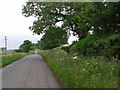
Cyclists turning on to the Fosse Way near Lordswood Farm
The Fosse Way is a Roman Road.
Image: © Vieve Forward
Taken: 4 Nov 2020
0.14 miles
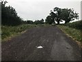
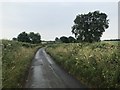
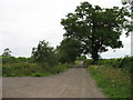
7
Fosse Way Byway
Where the BOAT leaves the tarmac between Sherston and Norton. Looking north-east.
Image: © James Ayres
Taken: 5 Dec 2009
0.20 miles
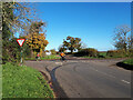
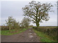
9
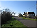
Lordswood Cottage
A view looking south along the lane from Sherston towards Lordswood cottage .
Image: © Phil Williams
Taken: 10 Apr 2006
0.21 miles