IMAGES TAKEN NEAR TO
SN16 0FU
Introduction
This page details the photographs taken nearby to SN16 0FU by members of the Geograph project.
The Geograph project started in 2005 with the aim of publishing, organising and preserving representative images for every square kilometre of Great Britain, Ireland and the Isle of Man.

There are currently over 7.5m images from over14,400 individuals and you can help contribute to the project by visiting https://www.geograph.org.uk
Image Map
Images are licensed for reuse under creativecommons.org/licenses/by-sa/2.0
Notes
- Clicking on the map will re-center to the selected point.
- The higher the marker number, the further away the image location is from the centre of the postcode.
Image Listing (29 Images Found)
Images are licensed for reuse under creativecommons.org/licenses/by-sa/2.0
Image
Details
Distance
1
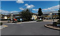
Athelstan House, Malmesbury
Athelstan House is a recently-built care home with 80 single rooms, located in Priory Way, Burton Hill.
Image: © Jaggery
Taken: 17 Aug 2014
0.05 miles
2
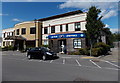
Boots Pharmacy in Malmesbury Primary Care Centre
Viewed across Priory Way. The main entrance to the Care Centre is on the left.
Image: © Jaggery
Taken: 17 Aug 2014
0.08 miles
3
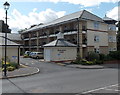
Townsend Court, Malmesbury
Extra care housing in Priory Way, Burton Hill, opposite Malmesbury Primary Care Centre. http://www.geograph.org.uk/photo/4125411
Image: © Jaggery
Taken: 17 Aug 2014
0.09 miles
4
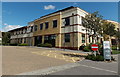
Malmesbury Primary Care Centre
The Centre in Priory Way Malmesbury opened in June 2008.
This site was previously occupied by the Community Hospital.
Image: © Jaggery
Taken: 17 Aug 2014
0.09 miles
7
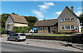
Malmesbury Police Station
Part of the Wiltshire Police force, viewed across the A429 in the Burton Hill area of Malmesbury.
Image: © Jaggery
Taken: 17 Aug 2014
0.11 miles
8
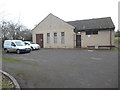
Malmesbury Telephone Exchange
Situated at Burton Hill near the roundabout of the A429 and B4042 roads, this modern TE is built of Cotswold stone and has the code SSMAL. It serves 3,501 residential and 303 non-residential premises in Malmesbury plus Brokenborough, Charlton, Cleverton, Corston, Foxley, Garsdon, Lea, Little Somerford and Rodbourne nearby. Two vehicles can be seen to the left of the photo. This TE has the numbering range (01666) 82xxxx, the (01666) referring to the nine TEs in the Malmesbury group, and its postcode is SN16 0EL.
Image: © David Hillas
Taken: 13 Jan 2018
0.11 miles
9
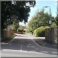
Arches Lane, Malmesbury
On the west side of the A429, in the south of Malmesbury.
Image: © Jaggery
Taken: 17 Aug 2014
0.12 miles