
IMAGES TAKEN NEAR TO
Curtis Street, SWINDON, SN1 5JU
Introduction
This page details the photographs taken nearby to Curtis Street, SN1 5JU by members of the Geograph project.
The Geograph project started in 2005 with the aim of publishing, organising and preserving representative images for every square kilometre of Great Britain, Ireland and the Isle of Man.

There are currently over 7.5m images from over14,400 individuals and you can help contribute to the project by visiting https://www.geograph.org.uk
Image Map
Images are licensed for reuse under creativecommons.org/licenses/by-sa/2.0
Notes
- Clicking on the map will re-center to the selected point.
- The higher the marker number, the further away the image location is from the centre of the postcode.
Image Listing (393 Images Found)
Images are licensed for reuse under creativecommons.org/licenses/by-sa/2.0
Image
Details
Distance
2
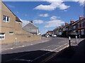
Looking east-southeast in Crombey Street
Image: © Basher Eyre
Taken: 14 Jul 2022
0.02 miles
3
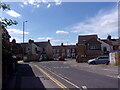
Approaching a slight bend in Crombey Street
Image: © Basher Eyre
Taken: 14 Jul 2022
0.02 miles
5
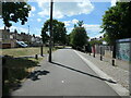
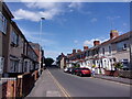
Route of the Wilts & Berks canal, near Tennyson Street
The Wilts & Berks canal opened in 1810, linking the Kennet & Avon canal with the River Thames and running right through Swindon. It closed in 1914, but is now partly restored. The houses on both sides of the canal here [Curtis Street and Tennyson Street] were built between 1885 and 1899.
Image: © Christine Johnstone
Taken: 14 Jul 2022
0.03 miles
6
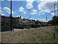
Houses in Curtis Street, Swindon
Built between 1885 and 1889 on the south bank of the Wilts & Berks canal.
Image: © Christine Johnstone
Taken: 14 Jul 2022
0.03 miles
7
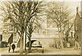
Canal site at Milton Road
The course of the former Wilts & Berks canal near the centre of Swindon. Taken in 1968 the photo shows the bridge taking Milton Road over the canal. This section still had water in the 1920's though trade had declined from the moment the railways had arrived in Swindon in the 1840's.
Image: © Gordon Hatton
Taken: Unknown
0.04 miles
8
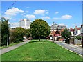
Route of Wilts and Berks canal, Swindon
The canal fell into disuse about 100 years ago. This view is along the line of the route facing north-east. Ahead is Milton Road bridge hidden by the tree. The silver building is the David Murray John tower. The car at the right is in the back yard of a house in Curtis Street.
Image: © Brian Robert Marshall
Taken: 24 Jul 2008
0.04 miles
9
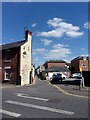
Looking across Curtis Street towards The Rolleston Arms Hotel
The alley to its right runs right through to Whitney Street
Image: © Basher Eyre
Taken: 14 Jul 2022
0.04 miles
10
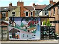
Wall painting, rear of Tennyson Street, Swindon
The artists are unknown to me. Interestingly it hasn't been tagged like the adjacent fence. That makes me wonder if the artists aren't reformed taggers. The houses in the background are in Tennyson Street. The building on the right is in Milton Road.
Image: © Brian Robert Marshall
Taken: 24 Jul 2008
0.05 miles