IMAGES TAKEN NEAR TO
London Street, SWINDON, SN1 5DG
Introduction
This page details the photographs taken nearby to London Street, SN1 5DG by members of the Geograph project.
The Geograph project started in 2005 with the aim of publishing, organising and preserving representative images for every square kilometre of Great Britain, Ireland and the Isle of Man.

There are currently over 7.5m images from over14,400 individuals and you can help contribute to the project by visiting https://www.geograph.org.uk
Image Map
Images are licensed for reuse under creativecommons.org/licenses/by-sa/2.0
Notes
- Clicking on the map will re-center to the selected point.
- The higher the marker number, the further away the image location is from the centre of the postcode.
Image Listing (870 Images Found)
Images are licensed for reuse under creativecommons.org/licenses/by-sa/2.0
Image
Details
Distance
2

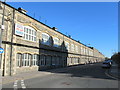
A mysterious mark, London Street, Swindon
According to the 1900 Ordnance Survey map there is a bench mark at 327.8 feet above 'the assumed Mean Level of the Sea at Liverpool which is 0.650 of a Foot below the general Mean Level of the Sea' at this location. However, this doesn't look like any other bench mark I've seen and is more likely to be a mason's mark. It can be seen in context here Image
Image: © Brian Robert Marshall
Taken: 21 Sep 2010
0.01 miles
3
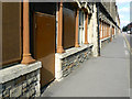
London Street, Swindon
The possible cut mark (or bench mark) seen close up here Image is visible just this side of the doorway in the first course of the stonework beneath the cill. The building is part of what was once the Great Western Railway's main factory established by I K Brunel in the mid 19th century. I think this was the carriage and wagon works.
Image: © Brian Robert Marshall
Taken: 21 Sep 2010
0.01 miles
4
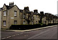
London Street chimneys, Swindon
London Street is part of the Railway Village built by the Great Western Railway
in the mid 19th century to house its employees near its main railway works.
Image: © Jaggery
Taken: 15 Mar 2015
0.01 miles
5

Oxford Street, Swindon
The street is in the eastern part of what is known locally as the Railway Village. The estate of workers' cottages was built in the mid 1800s for the specific purpose of housing workers in Brunel's Great Western Railway factory. The estate was quite run down by the 1970s when what was then the British Rail Property Board sold it lock, stock and barrel to the local council who embarked on a comprehensive programme of repair and improvement on completion of which the houses passed into their housing stock. The properties in the estate are all listed for example http://www.imagesofengland.org.uk/details/default.aspx?id=318792 The small tree is looking splendid in its autumn colours.
Image: © Brian Robert Marshall
Taken: 1 Nov 2010
0.02 miles
6
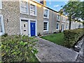
Swindon : Oxford Street
Houses on Oxford Street in Swindon.
Image: © Lewis Clarke
Taken: 14 Jul 2022
0.02 miles
7
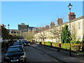
Former Railway Workers' Cottages Oxford Street Swindon
Image: © Roy Hughes
Taken: 27 Oct 2018
0.02 miles
8
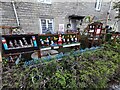
Swindon : Oxford Street
A house with lots of gnomes outside.
Image: © Lewis Clarke
Taken: 14 Jul 2022
0.02 miles
9
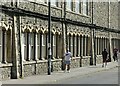
Workshed, Swindon
Workshed is a project to provide a variety of business facilities from shared workspace to small offices, within the former carriage building works of the Great Western Railway. The ground floor window arcades are a particular feature of the building. It includes the former no.7 and no.8 shops, built c.1870-80, Listed Grade II with separate listings for each shop. This view is mainly of no.7 shop.
Image: © Alan Murray-Rust
Taken: 14 Jul 2022
0.02 miles