
IMAGES TAKEN NEAR TO
Old Forge Close, CHIPPENHAM, SN15 5HW
Introduction
This page details the photographs taken nearby to Old Forge Close, SN15 5HW by members of the Geograph project.
The Geograph project started in 2005 with the aim of publishing, organising and preserving representative images for every square kilometre of Great Britain, Ireland and the Isle of Man.

There are currently over 7.5m images from over14,400 individuals and you can help contribute to the project by visiting https://www.geograph.org.uk
Image Map
Images are licensed for reuse under creativecommons.org/licenses/by-sa/2.0
Notes
- Clicking on the map will re-center to the selected point.
- The higher the marker number, the further away the image location is from the centre of the postcode.
Image Listing (119 Images Found)
Images are licensed for reuse under creativecommons.org/licenses/by-sa/2.0
Image
Details
Distance
1
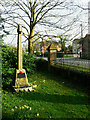
War memorial, Brinkworth cemetery
The memorial would originally have been installed to commemorate the Fallen of the Great War. The plaque facing the viewpoint is in memory of those soldiers of the village who died in WWII.
Image: © Brian Robert Marshall
Taken: 17 Mar 2009
0.04 miles
2
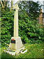
War memorial, Brinkworth cemetery
The south-facing elevation contains the names of those soldiers of the locality who died in the Great War. The small plaque commemorates those who died in WWII.
Image: © Brian Robert Marshall
Taken: 17 Mar 2009
0.04 miles
3
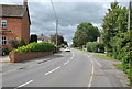
The Street/B4042, Brinkworth, Wiltshire 2019
The village is recorded as the longest village in England being 2.4 km.
Image: © Ray Bird
Taken: 22 Aug 2019
0.04 miles
4
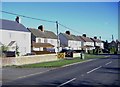
Main road, Brinkworth
A group of semi-detached dwellings bask in winter sunshine.
Image: © Roger Cornfoot
Taken: 23 Jan 2007
0.05 miles
5
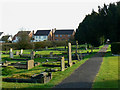
Brinkworth cemetery, Brinkworth
The cemetery is long and relatively narrow. In this view to the south houses fronting the B4042 Wootton Bassett to Malmesbury road can be seen. The cemetery doesn't appear to be as old as church graveyards: the earliest graves that I saw date from the late 19th century with one or two examples of Victorian symbolism.
Image: © Brian Robert Marshall
Taken: 17 Mar 2009
0.06 miles
6
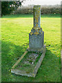
Grave of Emily Rumming, Brinkworth cemetery
Emily Jane Rumming died on 10th February 1901 aged 20. In so doing she died 19 days into the Edwardian period. Her grave though is typical of the Victorian era with the symbolic broken pillar representing a life cut short. There is another example in Stroud http://www.geograph.org.uk/photo/683875 The inscription on Emily's grave can be seen here http://www.geograph.org.uk/photo/1209866 Another example can be seen in Chirton http://www.geograph.org.uk/photo/1742226
Image: © Brian Robert Marshall
Taken: 17 Mar 2009
0.07 miles
7
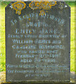
Inscription, grave of Emily Rumming, Brinkworth cemetery
This is the inscription on this tomb http://www.geograph.org.uk/photo/1209861
Image: © Brian Robert Marshall
Taken: 17 Mar 2009
0.07 miles
8
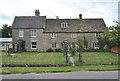
Cottages, The Street/B4042, Brinkworth, Wiltshire 2019
Image: © Ray Bird
Taken: 22 Aug 2019
0.07 miles
9
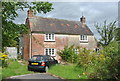
House, The Street/B4042, Brinkworth, Wiltshire 2019
Image: © Ray Bird
Taken: 22 Aug 2019
0.07 miles
10
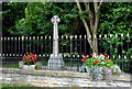
War Memorial, The Street/B4042, Brinkworth, Wiltshire 2019
Image: © Ray Bird
Taken: 22 Aug 2019
0.08 miles