
IMAGES TAKEN NEAR TO
Dauntsey Lock, CHIPPENHAM, SN15 4HF
Introduction
This page details the photographs taken nearby to SN15 4HF by members of the Geograph project.
The Geograph project started in 2005 with the aim of publishing, organising and preserving representative images for every square kilometre of Great Britain, Ireland and the Isle of Man.

There are currently over 7.5m images from over14,400 individuals and you can help contribute to the project by visiting https://www.geograph.org.uk
Image Map
Images are licensed for reuse under creativecommons.org/licenses/by-sa/2.0
Notes
- Clicking on the map will re-center to the selected point.
- The higher the marker number, the further away the image location is from the centre of the postcode.
Image Listing (9 Images Found)
Images are licensed for reuse under creativecommons.org/licenses/by-sa/2.0
Image
Details
Distance
1
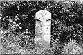
Old Milestone by the B4069, Swallett Gate
Swindon waist by the B4069 (was A420), in parish of Christian Malford (North Wiltshire District), Swallett Gate, by the Northeast side of road.
Lost since 2000.
Milestone Society National ID: WI_CPSN08
Image: © Milestone Society
Taken: Unknown
0.03 miles
2
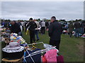
Old Dairy Farm car boot sale, Dauntsey Lock
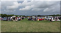
A car boot sale used to be held every Sunday morning during the summer (weather permitting) at Old Dairy Farm, Dauntsey Lock. 2021: The landowner informs us that these sales ceased some years ago.
Image: © Vieve Forward
Taken: 5 May 2013
0.09 miles
4
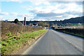
B4069 approaching Dauntsey Lock
A small settlement around a lock on the derelict Wilts and Berks Canal.
Image: © Robin Webster
Taken: 2 Feb 2018
0.16 miles
5
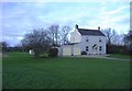
Cottage at Dauntsey
An unpretentious dwelling, set in large grounds.
Image: © Roger Cornfoot
Taken: 15 Jan 2007
0.18 miles
6
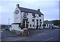
Peterborough Arms
A former canal-side public house, located next to Dauntsey lock on the Wilts and Berks canal. Much work has been undertaken nearby to restore the lock and canal basin.
Image: © Roger Cornfoot
Taken: 30 Dec 2006
0.21 miles
8
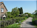
Path by Creamery Cottage
The public path from the wooden gate leads north-east across Dauntsey Vale.
Image: © Jonathan Billinger
Taken: 6 May 2008
0.22 miles
9

GWR railway line, London to Bristol
View west towards Bristol from the Wootton Bassett Overbridge at Dauntsey Lock
Image: © Eirian Evans
Taken: 1 Feb 2016
0.24 miles