IMAGES TAKEN NEAR TO
Lye Common, CHIPPENHAM, SN15 4BH
Introduction
This page details the photographs taken nearby to Lye Common, SN15 4BH by members of the Geograph project.
The Geograph project started in 2005 with the aim of publishing, organising and preserving representative images for every square kilometre of Great Britain, Ireland and the Isle of Man.

There are currently over 7.5m images from over14,400 individuals and you can help contribute to the project by visiting https://www.geograph.org.uk
Image Map
Images are licensed for reuse under creativecommons.org/licenses/by-sa/2.0
Notes
- Clicking on the map will re-center to the selected point.
- The higher the marker number, the further away the image location is from the centre of the postcode.
Image Listing (35 Images Found)
Images are licensed for reuse under creativecommons.org/licenses/by-sa/2.0
Image
Details
Distance
1
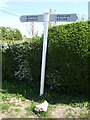
Signpost on Station Road
Clean and simple lines, no mileage.
Image: © Neil Owen
Taken: 17 Apr 2021
0.07 miles
3

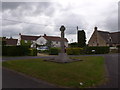
Central Cross, Christian Malford
In the garden of Croscote, behind tall hedges. This view is looking West from the Eastern section of "the Green" which
was enclosed in the 19ᵗʰC sometime between 1808 and 1840 when the tithe maps were produced..
Christian Malford was significant being the terminus for 3 or 4 toll roads under separate turnpike trusts up to abut 1845.
Grade II Listed Nᴼ 1199724 see https://historicengland.org.uk/listing/the-list/list-entry/1199724
Milestone Society National ID: WINW_CHR
Image: © Mr Red
Taken: 22 May 2026
0.10 miles
4
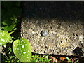
Rivet benchmark on Christian Malford hall
The steps to the doorway hold a rivet benchmark. See https://www.bench-marks.org.uk/bm55981 for the entry in the Benchmark Database and Image] for a wider view.
Image: © Neil Owen
Taken: 17 Apr 2021
0.10 miles
5
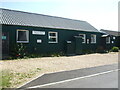
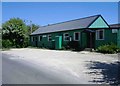
Christian Malford Village Hall
The hall is mainly made from corrugated sheeting. It was in fact a temporary field hospital on Salisbury Plain during WWI; it was then packed and sent to Christian Malford in the 1920s. On the far end is the entrance with a small canopy: on the concrete steps is a rivet benchmark - see Image
Image: © Neil Owen
Taken: 17 Apr 2021
0.10 miles
8
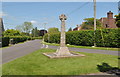
War Memorial, Christian Malford, Wiltshire 2015
Image: © Ray Bird
Taken: 21 May 2015
0.12 miles
9

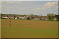
Waterlogged field, Christian Malford
Footpath CMAL22 crosses this field from a bridge under the railway line from which this was taken, past Lye Common House. The trees just this side of the house are beside a pond that is supposed to be there; the other bodies of water aren't.
Image: © Derek Harper
Taken: 23 Nov 2012
0.12 miles