IMAGES TAKEN NEAR TO
Provis Mead, CHIPPENHAM, SN15 3UA
Introduction
This page details the photographs taken nearby to Provis Mead, SN15 3UA by members of the Geograph project.
The Geograph project started in 2005 with the aim of publishing, organising and preserving representative images for every square kilometre of Great Britain, Ireland and the Isle of Man.

There are currently over 7.5m images from over14,400 individuals and you can help contribute to the project by visiting https://www.geograph.org.uk
Image Map
Images are licensed for reuse under creativecommons.org/licenses/by-sa/2.0
Notes
- Clicking on the map will re-center to the selected point.
- The higher the marker number, the further away the image location is from the centre of the postcode.
Image Listing (17 Images Found)
Images are licensed for reuse under creativecommons.org/licenses/by-sa/2.0
Image
Details
Distance
1
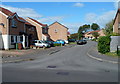
Christopher Drive, Chippenham
A cul-de-sac on the north side of King Henry Drive.
Image: © Jaggery
Taken: 14 Sep 2012
0.09 miles
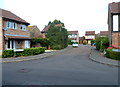
2
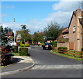
Lockswell Close, Chippenham
A cul-de-sac on the north side of King Henry Drive.
Image: © Jaggery
Taken: 14 Sep 2012
0.10 miles
3
Hedge Row, Chippenham
A cul-de-sac on the NE side of King Henry Drive.
Image: © Jaggery
Taken: 14 Sep 2012
0.11 miles
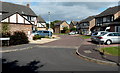
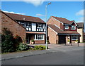
4
2011 : Lockswell Close, Chippenham
A new development on the outskirts of Chippenham in the direction of Pewsham.
Some good looking houses here, handy for the A4.
Image: © Maurice Pullin
Taken: 3 Jun 2011
0.12 miles
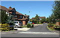
5
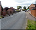
Lodge Road, Chippenham
Viewed from the Pewsham Road end looking west.
Image: © Jaggery
Taken: 14 Sep 2012
0.12 miles
6
Monks Way houses, Chippenham
Viewed from the corner of King Henry Drive.
Image: © Jaggery
Taken: 14 Sep 2012
0.13 miles
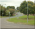
7
Bramble Drive, Chippenham
Bramble Drive is a cul-de-sac on the NE side of a main road through the estate.
This junction is where King Henry Drive to the SE (right) becomes Blackthorn Mews to the NW.
Image: © Jaggery
Taken: 14 Sep 2012
0.14 miles
8
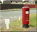
2009 : EIIR pillarbox and other street furniture
Gas main markers I think.
On the corner of Lodge Road and Roman Way.
Image: © Maurice Pullin
Taken: 25 Sep 2009
0.15 miles
9
2009 : Lodge Road, east Chippenham
A residential road off Pewsham Way.
Image: © Maurice Pullin
Taken: 25 Sep 2009
0.15 miles
10
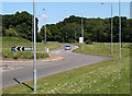
2011 : A4 King's Roundabout and Pewsham Way
Heading toward Calne.
The roundabout is at the end of King Henry Drive.
Image: © Maurice Pullin
Taken: 3 Jun 2011
0.16 miles