
IMAGES TAKEN NEAR TO
Bradbury Close, CHIPPENHAM, SN15 3TN
Introduction
This page details the photographs taken nearby to Bradbury Close, SN15 3TN by members of the Geograph project.
The Geograph project started in 2005 with the aim of publishing, organising and preserving representative images for every square kilometre of Great Britain, Ireland and the Isle of Man.

There are currently over 7.5m images from over14,400 individuals and you can help contribute to the project by visiting https://www.geograph.org.uk
Image Map
Images are licensed for reuse under creativecommons.org/licenses/by-sa/2.0
Notes
- Clicking on the map will re-center to the selected point.
- The higher the marker number, the further away the image location is from the centre of the postcode.
Image Listing (24 Images Found)
Images are licensed for reuse under creativecommons.org/licenses/by-sa/2.0
Image
Details
Distance
1
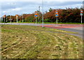
Many road signs alongside London Road, Chippenham
Located at the SE edge of town, viewed looking into Chippenham.
Image: © Jaggery
Taken: 14 Sep 2012
0.08 miles
2
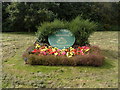
Welcome to Chippenham
The Chippenham Town Council Welcome disc is a flowerbed alongside
the A4 Pewsham Way near a road junction at the SE edge of the town.
Image: © Jaggery
Taken: 14 Sep 2012
0.08 miles
3
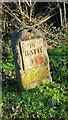
Old Milestone by London Road, Bremhill Parish
Metal plate attached to stone post by the UC road (was A4), in parish of BREMHILL (NORTH WILTSHIRE District), London Road; opposite The Turnpike, 25m South East of Gate Farmhouse, between old tollhouse and Pewsham Way roundabout, on grass verge 20m from tollhouse, on North side of road. Bath incised iron plate, erected by the Chippenham turnpike trust in the 18th century.
Inscription reads:-
TO
BATH
14
Grade II listed. List Entry Number: 1022433
https://historicengland.org.uk/listing/the-list/list-entry/1022433
Milestone Society National ID: WI_LB_BACN14.
Image: © A Rosevear
Taken: 2 Apr 2003
0.09 miles
4
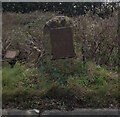
Old Milestone by London Road, Bremhill Parish
Metal plate attached to stone post by the UC road (was A4), in parish of BREMHILL (NORTH WILTSHIRE District), London Road; opposite The Turnpike, 25m South East of Gate Farmhouse, between old tollhouse and Pewsham Way roundabout, on grass verge 20m from tollhouse, on North side of road. Bath incised iron plate, erected by the Chippenham turnpike trust in the 18th century. An earlier photograph can be found here https://www.geograph.org.uk/photo/6044769.
Inscription reads:-
TO
BATH
14
Grade II listed. List Entry Number: 1022433 https://historicengland.org.uk/listing/the-list/list-entry/1022433
Milestone Society National ID: WI_LB_BACN14.
Image: © David Else
Taken: 3 Dec 2021
0.09 miles
5
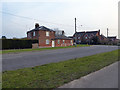
Gate Farmhouse, Stanley Lane
Grade II Listed former turnpike house on London Road/Stanley Lane junction, built circa 1830-1840, and extended as a farmhouse in the mid- to late 19th century. http://www.britishlistedbuildings.co.uk/en-316192-gate-farmhouse-chippenham-#.VuhwhP_cuUk
Image: © Vieve Forward
Taken: 12 Mar 2016
0.09 miles
6
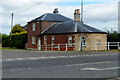
Former turnpike house, Chippenham
Located on the corner of London Road and Stanley Lane, at the SE edge of Chippenham.
The single storey turnpike toll house was built in the 1830s.
The farmhouse behind it was a later 19th century extension.
Image: © Jaggery
Taken: 14 Sep 2012
0.10 miles
7
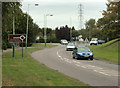
2009 : A lot of leaning lampposts near the corner of a street
George Formby would have had a whale of a time here, somebody should write a song about it.
The pylon provides the standard for vertical.
At the eastern end of Pewsham Way, the roundabout where it joins the A4 is visible.
Image: © Maurice Pullin
Taken: 25 Sep 2009
0.10 miles
8
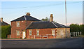
Old Toll House by London Road, Bremhill parish
London Road by the UC road (was A4), in parish of Bremhill (North Wiltshire District), Gate Farmhouse, London Road, South East of Chippenham, SN15 3XA.
Grade II listed.
List Entry Number: 1199337 https://historicengland.org.uk/listing/the-list/list-entry/1199337
Surveyed
Milestone Society National ID: WI.BRE
Image: © Alan Rosevear
Taken: Unknown
0.10 miles
9
Roundabout at the end of Pewsham Way
This is where the new A4 leaves the old A4, sending unwitting traffic right around Chippenham instead of actually into it less than a mile west.
Image: © David Howard
Taken: 24 Apr 2016
0.10 miles
10
2009 : EIIR pillarbox and other street furniture
Gas main markers I think.
On the corner of Lodge Road and Roman Way.
Image: © Maurice Pullin
Taken: 25 Sep 2009
0.11 miles