
IMAGES TAKEN NEAR TO
Wood Lane, CHIPPENHAM, SN15 3DJ
Introduction
This page details the photographs taken nearby to Wood Lane, SN15 3DJ by members of the Geograph project.
The Geograph project started in 2005 with the aim of publishing, organising and preserving representative images for every square kilometre of Great Britain, Ireland and the Isle of Man.

There are currently over 7.5m images from over14,400 individuals and you can help contribute to the project by visiting https://www.geograph.org.uk
Image Map
Images are licensed for reuse under creativecommons.org/licenses/by-sa/2.0
Notes
- Clicking on the map will re-center to the selected point.
- The higher the marker number, the further away the image location is from the centre of the postcode.
Image Listing (258 Images Found)
Images are licensed for reuse under creativecommons.org/licenses/by-sa/2.0
Image
Details
Distance
1
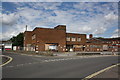
Chippenham Police station for sale
No doubt further housing development will follow. See Image for view when in use. When I think back it hadn't been permanently manned at nights or weekends for years and had a phone connection to the local divisional HQ in Semington.
Image: © John Stephen
Taken: 29 Jun 2014
0.03 miles
2
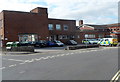
Chippenham Police Station
At the September 2012 date of this view, Chippenham Police Station was located here, on the corner of Wood Lane and The Paddocks. In March 2013, this police station closed down after officers completed their move to a new base at the council offices at Monkton Park.
Image: © Jaggery
Taken: 14 Sep 2012
0.04 miles
3
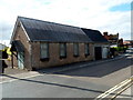
Wood Lane hall, Chippenham
Viewed from the corner of Burlands Road. There was no name sign to indicate the usage of the hall.
Image: © Jaggery
Taken: 14 Sep 2012
0.05 miles
4
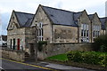
Houses in former school building
The building looks very much like a former school, and has been converted and subdivided as part of a residential development on the same street, to the left.
Image: © David Martin
Taken: 4 Nov 2017
0.05 miles
5

The Cause - Music & Craft Centre - The Causeway
Image: © Betty Longbottom
Taken: 28 Aug 2008
0.05 miles
6
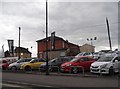
Vauxhall garage on The Causeway, Chippenham
Image: © David Howard
Taken: 24 Apr 2016
0.05 miles
7
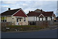
Bungalows at the junction of Wood Lane and Burlands Road
Image: © David Martin
Taken: 4 Nov 2017
0.05 miles
8
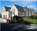
Bakehouse Close, Chippenham
I guessed that this used to be a school, but the name sign shows Bakehouse Close.
The 3 doors are on houses numbered 17, 18 and 19. Viewed across Wood Lane.
Update. Thanks to Sharon Sawyer who told me that this used to be Westmead Junior School. It closed in 1989 and lay empty for about ten years before being converted into flats.
Image: © Jaggery
Taken: 14 Sep 2012
0.06 miles
9
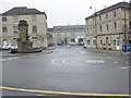
Chippenham Cenotaph
A view cross Chippenham market place. The building in the middle is the suppose site of King Alfred's hunting lodge.
Image: © richard noyes
Taken: 24 Apr 2003
0.06 miles
10
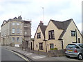
Old Cottage at the end of St Marys Street
Image: © chris morton
Taken: 7 May 2010
0.06 miles