
IMAGES TAKEN NEAR TO
Bowden Hill, CHIPPENHAM, SN15 2PJ
Introduction
This page details the photographs taken nearby to Bowden Hill, SN15 2PJ by members of the Geograph project.
The Geograph project started in 2005 with the aim of publishing, organising and preserving representative images for every square kilometre of Great Britain, Ireland and the Isle of Man.

There are currently over 7.5m images from over14,400 individuals and you can help contribute to the project by visiting https://www.geograph.org.uk
Image Map
Images are licensed for reuse under creativecommons.org/licenses/by-sa/2.0
Notes
- Clicking on the map will re-center to the selected point.
- The higher the marker number, the further away the image location is from the centre of the postcode.
Image Listing (24 Images Found)
Images are licensed for reuse under creativecommons.org/licenses/by-sa/2.0
Image
Details
Distance
1
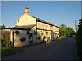
Bell Inn, Bowden Hill
Morning sun lights the roadside pub, also shown in http://www.geograph.org.uk/search.php?i=6618422 .
Image: © Derek Harper
Taken: 30 May 2009
0.00 miles
3
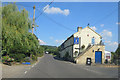
2009 : The Bell, Bewley Crescent (2)
At the end of Bewley Lane where it joins the road between Lacock and Bowden Hill, this was once a canalside pub and may be so again.
A close look at Image] reveals a slight hump in the road beyond the pub. This was a bridge over the Wilts. and Berks. Canal. A restoration group is presently hard at work rebuilding locks, bridges, spillweirs, etc. though they have yet to come up with a completion date. http://www.wbct.org.uk/
Image: © Maurice Pullin
Taken: 6 Jan 2009
0.02 miles
5
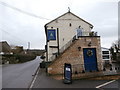
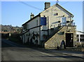
The Bell Inn, The Wharf
This pub would once have been near the canal, and has a reputation for real ale. http://www.thebellatlacock.co.uk/ The weather-vane on top of the pub is in the form of a keg and tankard.
Image: © HelenK
Taken: 1 Jan 2017
0.04 miles
6
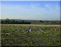
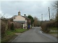
2009 : Field behind "The Bell"
The Wilts & Berks Canal crossed this field until it was filled in.
Image: © Maurice Pullin
Taken: 6 Jan 2009
0.05 miles
7
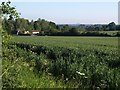
Field beside Bewley Common (2)
Another view from the same spot as Image, looking to the left. The houses on the left are on the lane past Bewley Court.
Image: © Derek Harper
Taken: 30 May 2009
0.09 miles
10
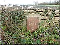
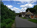
Old Milestone east of Lacock Bridge, Lacock parish
Metal plate attached to stone post by the UC road, in parish of LACOCK (NORTH WILTSHIRE District), East of Packhorse Bridge over River Avon, eastern approach, on stone in hedge, on North side of road. Bath incised iron plate, erected by the Lacock, Blue Vein (Corsham) turnpike trust in the 19th century.
Inscription reads:-
To
BATH
13
Milestone Society National ID: WI_LB_BABH13.
Image: © J Haynes
Taken: 18 Feb 2013
0.16 miles