
IMAGES TAKEN NEAR TO
Brooklands, CHIPPENHAM, SN15 2FH
Introduction
This page details the photographs taken nearby to Brooklands, SN15 2FH by members of the Geograph project.
The Geograph project started in 2005 with the aim of publishing, organising and preserving representative images for every square kilometre of Great Britain, Ireland and the Isle of Man.

There are currently over 7.5m images from over14,400 individuals and you can help contribute to the project by visiting https://www.geograph.org.uk
Image Map
Images are licensed for reuse under creativecommons.org/licenses/by-sa/2.0
Notes
- Clicking on the map will re-center to the selected point.
- The higher the marker number, the further away the image location is from the centre of the postcode.
Image Listing (18 Images Found)
Images are licensed for reuse under creativecommons.org/licenses/by-sa/2.0
Image
Details
Distance
1
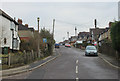
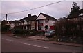
2011 : Rowden Road, Chippenham
A cul-de-sac off the A4 south west of Chippenham. Residential, appears to be mostly 1920s / '30s.
Image: © Maurice Pullin
Taken: 21 Jan 2011
0.18 miles
2
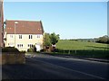
Edge of town
The houses in Coppice Close are on the very edge of the town of Chippenham. Seen from the bridge which carries the road over Ladyfield Brook.
Image: © Michael Dibb
Taken: 22 Apr 2017
0.18 miles
3
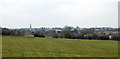
2011 : View from the end of Rowden Lane
Looking north east across Chippenham. The spire if St.Andrew's Church is evident.
20 years from now people may be saying "So that is what it looked like without all the houses."
Image: © Maurice Pullin
Taken: 21 Jan 2011
0.21 miles
5
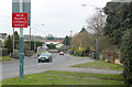
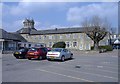
2011 : A4 Chippenham heading south west
Corsham, Box and Bath before us. The A4 ends at Avonmouth on the other side of Bristol.
Image: © Maurice Pullin
Taken: 21 Jan 2011
0.22 miles
7
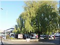
The pub with the tree
The Rowden Arms is nothing special but the tree is magnificent.
Image: © Michael Dibb
Taken: 22 Apr 2017
0.23 miles
8
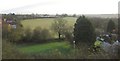
Patterdown, Chippenham
A view over the B4634 (indicated by the street light) from the railway line southwest of Chippenham. The valley is that of the Pudding Brook, and on the extreme left is new housing on Coppice Close.
Image: © Derek Harper
Taken: 23 Nov 2012
0.23 miles
9
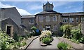
Chippenham Hospital, Wiltshire
The main entrance to Chippenham Hospital.
Image: © Rebecca A Wills
Taken: 5 May 2022
0.23 miles
10
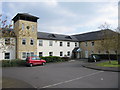
Avon Court Care Home
At St.Francis Avenue, Rowden Hill, Chippenham.
Image: © Ben Croft
Taken: 9 Apr 2007
0.23 miles