
IMAGES TAKEN NEAR TO
Field Rise, SWINDON, SN1 4HP
Introduction
This page details the photographs taken nearby to Field Rise, SN1 4HP by members of the Geograph project.
The Geograph project started in 2005 with the aim of publishing, organising and preserving representative images for every square kilometre of Great Britain, Ireland and the Isle of Man.

There are currently over 7.5m images from over14,400 individuals and you can help contribute to the project by visiting https://www.geograph.org.uk
Image Map
Images are licensed for reuse under creativecommons.org/licenses/by-sa/2.0
Notes
- Clicking on the map will re-center to the selected point.
- The higher the marker number, the further away the image location is from the centre of the postcode.
Image Listing (32 Images Found)
Images are licensed for reuse under creativecommons.org/licenses/by-sa/2.0
Image
Details
Distance
1
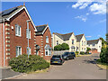
Field Rise
Houses in Field Rise, completed in 2001.
Image: © Ian Capper
Taken: 14 Jul 2022
0.01 miles
2

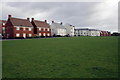
Old Railway Path, Swindon
Winter scene on the old railway line near Wichelstowe.
Image: © Wayland Smith
Taken: 2 Feb 2019
0.05 miles
4
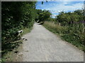
A rare bench on NCR 45
The former Midland & South Western Junction Railway, which runs west-east along the southern edge of Swindon.
Image: © Christine Johnstone
Taken: 14 Jul 2022
0.06 miles
5
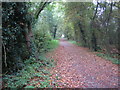
Swindon: Dismantled railway line near Okus
This is the trackbed of part of the dismantled former Midland and South Western Junction Railway (M&SWJR) between Swindon Town and Cirencester stations. It was open for passenger traffic between 1883 and 1961.
Looking in the direction of the former Swindon Town station, this is now part of the National Cycle Network Route 45, which will eventually connect Salisbury in Wiltshire with Chester in Cheshire, via Swindon, Cirencester, Gloucester, Worcester and Whitchurch.
Image: © Nigel Cox
Taken: 26 Oct 2007
0.11 miles
6
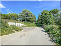
Mill Lane
Lane connecting West Leaze and the Swindon suburb of Okus, seen here before it passes under Old Town Cycle Path. Until recently it was a through route, but it was closed in 2021 to avoid it being used as a rat run and lorry route for the new housing development at Wichelstowe, at the same time creating a quiet route for cyclists and pedestrians. This closure included the installation of a gate, just visible in the shadows in the background, and of the turning point on the left of the photo.
Image: © Ian Capper
Taken: 14 Jul 2022
0.13 miles
7
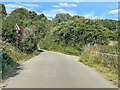
Mill Lane
Lane connecting West Leaze and the Swindon suburb of Okus and on to Old Town, seen here before it passes under Old Town Cycle Path. Until recently it was a through route, but it was closed in 2021 to avoid it being used as a rat run and lorry route for the new housing development at Wichelstowe, at the same time creating a quiet route for cyclists and pedestrians. Seen here where it crosses the River Ray.
Image: © Ian Capper
Taken: 14 Jul 2022
0.15 miles
8
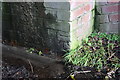
Benchmark on former railway bridge, Mill Lane
Ordnance Survey cut mark benchmark described on the Bench Mark Database at http://www.bench-marks.org.uk/bm40820
Image: © Roger Templeman
Taken: 5 Jan 2012
0.16 miles
9
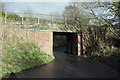
Former rail bridge over Mill Lane
The bridge now carries a national cycle way. There is an OS benchmark Image on the right hand side wall of the bridge
Image: © Roger Templeman
Taken: 5 Jan 2012
0.16 miles
10
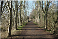
Old Railway Path, Mill Lane Bridge
A path and cycleway along an old railway track by where it crosses over Mill Lane.
Image: © Des Blenkinsopp
Taken: 19 Jan 2023
0.16 miles