
IMAGES TAKEN NEAR TO
Quarry Mews, SWINDON, SN1 4EJ
Introduction
This page details the photographs taken nearby to Quarry Mews, SN1 4EJ by members of the Geograph project.
The Geograph project started in 2005 with the aim of publishing, organising and preserving representative images for every square kilometre of Great Britain, Ireland and the Isle of Man.

There are currently over 7.5m images from over14,400 individuals and you can help contribute to the project by visiting https://www.geograph.org.uk
Image Map
Images are licensed for reuse under creativecommons.org/licenses/by-sa/2.0
Notes
- Clicking on the map will re-center to the selected point.
- The higher the marker number, the further away the image location is from the centre of the postcode.
Image Listing (154 Images Found)
Images are licensed for reuse under creativecommons.org/licenses/by-sa/2.0
Image
Details
Distance
1
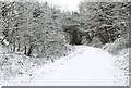
Old Town Rail Path near Springfield Road Bridge, in winter
At this point the former railway line ran in this deep cutting, and then passed under the bridge carrying Springfield Road over it. Today it is a cycleway and public footpath. Image
Image: © P L Chadwick
Taken: Unknown
0.04 miles
2
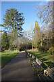
Park Seating in Town Gardens
As is often the case, these park seats are sponsored in memory of loved ones. Floral tributes are left.
Image: © Des Blenkinsopp
Taken: 19 Jan 2023
0.04 miles
3
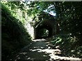
Sunlight and shade under Westlecot Road
The former Midland & South Western Junction Railway, which runs west-east along the southern edge of Swindon and is now part of NCR 45.
Image: © Christine Johnstone
Taken: 14 Jul 2022
0.04 miles
4
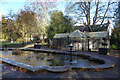
Pond and Aviary, Town Gardens
On a cold January afternoon with the pond partly frozen.
In the aviary the budgies were twittering about happily enough. I hope it's heated for them. Minus 6 forecast for tonight.
Image: © Des Blenkinsopp
Taken: 19 Jan 2023
0.05 miles
5
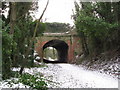
Westlecot Road bridge, Swindon
On the route of the former Midland & South Western Junction Railway, in Old Town, Swindon. This path is now part of National Cycle Network Route 45.
Image: © Gareth James
Taken: 27 Dec 2010
0.05 miles
6
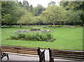
Town Gardens display
Once these grounds were part of the local Goddard estate, but the discovery of good quality Purbeck Limestone here led to a large quarry being opened up. After the majority of stone was extracted the council purchased the site in 1894; the old workings were then used largely for dumping waste from the expansion of the town and the canals. In 1902 the formal work to establish these fine gardens began, resulting in the tranquil and varied surroundings today.
Image: © Neil Owen
Taken: 4 Sep 2014
0.05 miles
7
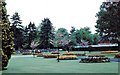
Town Gardens 1962
The Town Gardens have been an attractive open space in the Old Town area of Swindon for many decades. I wonder if the fish pond, bird aviaries and outdoor concert stage are still there?
Image: © Gordon Hatton
Taken: Unknown
0.05 miles
8
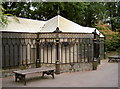
The Aviary
This popular birdhouse is a newer aviary, built in 1994. It replaced an older structure that originates from 1929. The many inhabitants (mainly smaller varieties of finches and budgerigars) create a constant chatter.
Image: © Neil Owen
Taken: 4 Sep 2014
0.05 miles
9
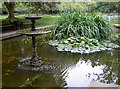
Town Garden pond
Originally an oval with a small island in the middle dating from 1894 (when the gardens were bought by the council), it was altered in the 1930s to the layout we see today.
Image: © Neil Owen
Taken: 4 Sep 2014
0.05 miles
10
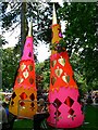
Swindon Mela, Town Gardens, Swindon (5)
The mela is an annual festival celebrating various aspects of South Asian culture. It is held in the Town Gardens municipal park in Old Town. A visitor to the event is taking a break in the shade. A very popular feature of the mela is the wide variety of South Asian refreshments available.
Next image: http://www.geograph.org.uk/photo/508280
NOTE. This image has a detailed ‘shared description’ which you won’t see by viewing this image on a slideshow. To read it click on the image.
Image: © Brian Robert Marshall
Taken: 28 Jul 2007
0.05 miles