
IMAGES TAKEN NEAR TO
Doncombe, CHIPPENHAM, SN14 8SF
Introduction
This page details the photographs taken nearby to Doncombe, SN14 8SF by members of the Geograph project.
The Geograph project started in 2005 with the aim of publishing, organising and preserving representative images for every square kilometre of Great Britain, Ireland and the Isle of Man.

There are currently over 7.5m images from over14,400 individuals and you can help contribute to the project by visiting https://www.geograph.org.uk
Image Map
Images are licensed for reuse under creativecommons.org/licenses/by-sa/2.0
Notes
- Clicking on the map will re-center to the selected point.
- The higher the marker number, the further away the image location is from the centre of the postcode.
Image Listing (8 Images Found)
Images are licensed for reuse under creativecommons.org/licenses/by-sa/2.0
Image
Details
Distance
1
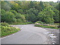
Bridge over Doncombe Brook
A view of the bridge over Doncombe Brook on the minor road from the A420 at The Shoe to Batheaston via Banner Down. The junction on the left is Doncombe Lane which goes to Colerne via the eastern perimeter of RAF Colerne. At right is the junction of Star Lane.
Image: © Phil Williams
Taken: 23 Sep 2005
0.12 miles
2
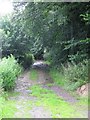
Southern end of Byway ST7973-01
Looking NNW 'up' the lane from the bridge at Doncombe Brook.
Image: © Warren Dukes
Taken: 24 Jul 2009
0.12 miles
3
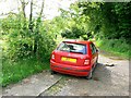
Byway with an abandoned Skoda, The Shoe, Wiltshire
The car has apparently been dumped at the entrance to the byway shown on the map as Star Lane. The car has suffered some vandalism and is missing a front tyre but otherwise doesn't look too bad. Only four years old as well.
Image: © Brian Robert Marshall
Taken: 31 May 2007
0.13 miles
4
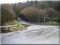
Road to Colerne past the Camp
Steep hill, gets very icy in winter
Image: © Stephen Bashford
Taken: 3 Dec 2005
0.14 miles
5
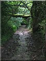
Fallen tree across byway ST7973-01
This is a view looking 'up' i.e. N/W along the track. The tree is wedged across the track about 6.5/7 feet above the track.
Image: © Warren Dukes
Taken: 24 Jul 2009
0.15 miles
6
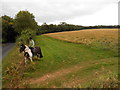
Horse Rider arriving at the Fosse Way
A footpath goes off across the field in the right foreground. The horse rider was arriving at the gate after having ridden round the field in the background. The modern road following the line of the Fosse Way can be seen on the left. There was a gap next to the gate so it was unnecessary for the rider to open the gate.
Image: © Nigel Mykura
Taken: 16 Sep 2012
0.18 miles
7
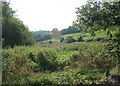
2008 : The valley of Doncombe Brook
Doncombe Brook rises near Marshfield and flows east until it reaches Ford where it joins By Brook.
Image: © Maurice Pullin
Taken: 26 Sep 2008
0.18 miles
8
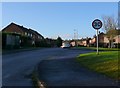
Pinewood Way
This is a small modern residential development on the northern edge of the large sprawling military development on the north side of Colerne Airfield.
Image: © Nigel Mykura
Taken: 17 Dec 2009
0.25 miles