
IMAGES TAKEN NEAR TO
Withymead Road, CHIPPENHAM, SN14 8PA
Introduction
This page details the photographs taken nearby to Withymead Road, SN14 8PA by members of the Geograph project.
The Geograph project started in 2005 with the aim of publishing, organising and preserving representative images for every square kilometre of Great Britain, Ireland and the Isle of Man.

There are currently over 7.5m images from over14,400 individuals and you can help contribute to the project by visiting https://www.geograph.org.uk
Image Map
Images are licensed for reuse under creativecommons.org/licenses/by-sa/2.0
Notes
- Clicking on the map will re-center to the selected point.
- The higher the marker number, the further away the image location is from the centre of the postcode.
Image Listing (68 Images Found)
Images are licensed for reuse under creativecommons.org/licenses/by-sa/2.0
Image
Details
Distance
1
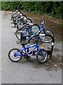
Cycle rack at Marshfield Primary School
A rare sight especially at a primary school - children are so often conveyed to school by car, however short the distance.
Image: © Oliver Dixon
Taken: 30 Jun 2017
0.03 miles
2
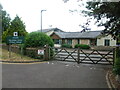
Marshfield Primary School
A modern school built at the east end of the village.
Image: © Neil Owen
Taken: 23 Jul 2022
0.06 miles
3
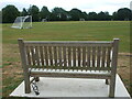
Memorial bench on Withymead Playing Fields
Marshfield Football Club has remembered one of its loyal servants with a bench overlooking the pitch.
Image: © Neil Owen
Taken: 23 Jul 2022
0.08 miles
4
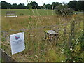
Bees instead of boules
The boules area in Withymead Playing Fields was used in the past but has fallen out of favour. Having laid redundant for too long, it has now been planted with nature-friendly plants.
Image: © Neil Owen
Taken: 23 Jul 2022
0.08 miles
5
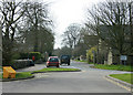
2010 : Chippenham Road, Marshfield
Formerly the A420. The turning to the right leads to the bypass a few yards away.
Image: © Maurice Pullin
Taken: 10 Apr 2010
0.08 miles
6
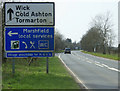
2010 : A420 Marshfield next left
"Village unsuitable for HGV's"
It managed about a dozen an hour before the bypass came.
Cold Ashton and the junction with the A46 two and a half miles further on, then Wick, Kingswood and Bristol.
Image: © Maurice Pullin
Taken: 10 Apr 2010
0.09 miles
7
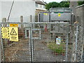
Withymead Road substation
Built with forensically marked equipment to deter anyone who has plans to pinch the high voltage kit.
Image: © Neil Owen
Taken: 23 Jul 2022
0.10 miles
8
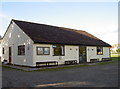
Withymead changing rooms
The town's sports facility and home to the football club.
Image: © Neil Owen
Taken: 18 Oct 2016
0.10 miles
9
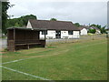
The bench and the changing room
Marshfield footballers will be familiar with the short jog from the pitch to a warm shower.
Image: © Neil Owen
Taken: 23 Jul 2022
0.10 miles
10
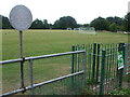
Marshfield Playing Fields
Known as Withymead Playing Fields, the 15 acre Leisure and Recreation area was purchased in 1948 for just under £1000 for the benefit of the locals. As part of the 2012 Diamond Jubilee celebrations the site was recognised as Fields in Trust.
Image: © Neil Owen
Taken: 23 Jul 2022
0.10 miles