
IMAGES TAKEN NEAR TO
West Littleton, CHIPPENHAM, SN14 8JB
Introduction
This page details the photographs taken nearby to SN14 8JB by members of the Geograph project.
The Geograph project started in 2005 with the aim of publishing, organising and preserving representative images for every square kilometre of Great Britain, Ireland and the Isle of Man.

There are currently over 7.5m images from over14,400 individuals and you can help contribute to the project by visiting https://www.geograph.org.uk
Image Map
Images are licensed for reuse under creativecommons.org/licenses/by-sa/2.0
Notes
- Clicking on the map will re-center to the selected point.
- The higher the marker number, the further away the image location is from the centre of the postcode.
Image Listing (71 Images Found)
Images are licensed for reuse under creativecommons.org/licenses/by-sa/2.0
Image
Details
Distance
1

Sheep lido
The farmland along Dunsdown Lane provides some water for sheep to enjoy. The water wends down the valley to join the Broadmead Brook.
Image: © Neil Owen
Taken: 9 Mar 2017
0.03 miles
2

2010 : Village green, West Littleton
Dunsdown Lane heads straight ahead, almost, to the A46.
Camp Lane, which is little more than a track to the right a short road to the parish church to the left and behind West Littleton Road goes to Marshfield.
"West Littleton is a small village located to the north west of Marshfield on rising ground. It boasts around 50 inhabitants, with 25 houses, a working farm and St James’ Church. It is located between the M4 and the A420. The closest amenities are to be found in Marshfield and the historical city of Bath is a short distance to the South. The National Trust property, Dryham House situated in Dyrham Park is located a few hundred metres from the village."
The above was copied from: http://westlittleton.com/
Image: © Maurice Pullin
Taken: 9 Jul 2010
0.03 miles
3
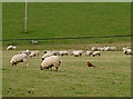
Trying to blend in
An intruder in the field tries to look inconspicuous. He's not pulling the wool over our eyes.
Image: © Neil Owen
Taken: 9 Mar 2017
0.03 miles
4

2010 : Road leading to Camp Lane, West Littleton
Green bin day.
The village green is to the left.
Image: © Maurice Pullin
Taken: 9 Jul 2010
0.06 miles
5
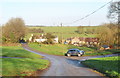
The Street, West Littleton, Gloucestershire 2015
Image: © Ray Bird
Taken: 23 Dec 2015
0.06 miles
6
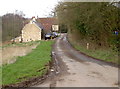
Camp Lane
This cul-de-sac reaches farmland only before stopping. The building nearest the camera was formerly an infants' school in the nineteenth century. It dates from 1825 and served for a few decades until 1897, when the children went to Marshfield for education.
Camp Lane is thought to be an ancient trackway that ran between the local strongholds around Dyrham. A camp road or ridgeway ran between the 'Fosse' and the 'Portway' from Castle Combe to Dyrham connecting the two roads and the Ebdown and Dyrham Camps. It is thought that Ceawlin the ruler of Wessex used this route when he attacked the Dyrham Camp and subsequently defeated the English at Dyrham in AD 577.
Image: © Neil Owen
Taken: 9 Mar 2017
0.07 miles
7
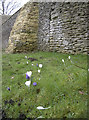
Camp Lane crocuses
Some seasonal blooms near the rebuilt wall along Camp Lane.
Image: © Neil Owen
Taken: 9 Mar 2017
0.08 miles
8
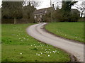
The path of flowers
Crocuses welcome visitors.
Image: © Neil Owen
Taken: 9 Mar 2017
0.09 miles
9
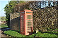
Phonebox, The Street, West Littleton, Gloucestershire 2015
Image: © Ray Bird
Taken: 23 Dec 2015
0.09 miles
10
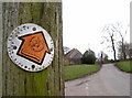
Round Avon Ride
The year of the arrow, 1991, seems a long time ago now - especially as the former county of Avon was dissolved in 1996. The route still sees plenty of hoofed visitors though.
Image: © Neil Owen
Taken: 9 Mar 2017
0.09 miles