
IMAGES TAKEN NEAR TO
Hinton, CHIPPENHAM, SN14 8HH
Introduction
This page details the photographs taken nearby to SN14 8HH by members of the Geograph project.
The Geograph project started in 2005 with the aim of publishing, organising and preserving representative images for every square kilometre of Great Britain, Ireland and the Isle of Man.

There are currently over 7.5m images from over14,400 individuals and you can help contribute to the project by visiting https://www.geograph.org.uk
Image Map
Images are licensed for reuse under creativecommons.org/licenses/by-sa/2.0
Notes
- Clicking on the map will re-center to the selected point.
- The higher the marker number, the further away the image location is from the centre of the postcode.
Image Listing (7 Images Found)
Images are licensed for reuse under creativecommons.org/licenses/by-sa/2.0
Image
Details
Distance
1
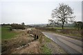
Boyd Bridge.
Road and Ring of Bells Farm from Boyds Bridge.
Image: © Derek Hawkins
Taken: 18 Feb 2007
0.10 miles
2
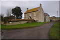
Ring o' Bells Farmhouse
A Grade II listed building, dated 1858, possibly incorporating earlier building.
Image: © Guy Wareham
Taken: 24 Dec 2011
0.13 miles
3
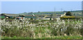
2010 : Ring o' Bells Farm from Boyd Bridge
On the minor road between Pucklechurch and Hinton.
Image: © Maurice Pullin
Taken: 23 Apr 2010
0.14 miles
4
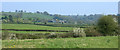
2010 : South east from Monarch's Way
Near Boyd Bridge. Looking across the hidden River Boyd to Talbot Farm at the foot of the Cotswold escarpment.
Image: © Maurice Pullin
Taken: 23 Apr 2010
0.14 miles
5
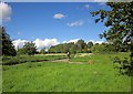
Hinton Common
A horse and rider progress up the road towards the village, seen from the track to Healey Court Farm.
Image: © Derek Harper
Taken: 29 May 2015
0.22 miles
6
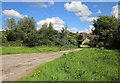
Track to Healey Court Farm
From the same spot as Image], looking to the right. You can't see the C17 farmhouse http://list.historicengland.org.uk/resultsingle.aspx?uid=1289561&searchtype=mapsearch from here.
Image: © Derek Harper
Taken: 29 May 2015
0.23 miles
7
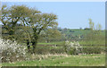
2010 : South on Monarch's Way
Very near Boyd Bridge.
The River Boyd flows here well hidden between its banks.
The south western edge of the Cotswolds can be seen.
Image: © Maurice Pullin
Taken: 23 Apr 2010
0.24 miles