
IMAGES TAKEN NEAR TO
Yatton Keynell, CHIPPENHAM, SN14 7JZ
Introduction
This page details the photographs taken nearby to SN14 7JZ by members of the Geograph project.
The Geograph project started in 2005 with the aim of publishing, organising and preserving representative images for every square kilometre of Great Britain, Ireland and the Isle of Man.

There are currently over 7.5m images from over14,400 individuals and you can help contribute to the project by visiting https://www.geograph.org.uk
Image Map
Images are licensed for reuse under creativecommons.org/licenses/by-sa/2.0
Notes
- Clicking on the map will re-center to the selected point.
- The higher the marker number, the further away the image location is from the centre of the postcode.
Image Listing (4 Images Found)
Images are licensed for reuse under creativecommons.org/licenses/by-sa/2.0
Image
Details
Distance
1
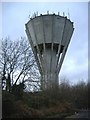
Water tower
Looking rather like a rocket which has nose-dived from outer-space. Sited on Springfield farm, north of Yatton Keynell.
Image: © Roger Cornfoot
Taken: 19 Jan 2007
0.05 miles
2
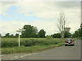
2009 : Road to Grittleton
At the crossroads. Yatton Keynell is behind, the signpost indidcates Easton Piercy to the right and a narrow lane left heads for Castle Combe via the B4039.
A closer view of the water tower appears in Image
Image: © Maurice Pullin
Taken: 20 Jun 2009
0.13 miles
3
2009 : Pasture north of Yatton Keynell
Wonder if cows like clover. I've tried it and it is much better than grass. Though too much would give them the bloat.
Image: © Maurice Pullin
Taken: 20 Jun 2009
0.19 miles
4
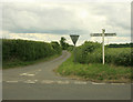
2009 : Misleading signpost?
Grittleton OK, but if I wanted to go to Castle Combe I would go straight ahead or if in a large vehicle turn left through Yatton Keynell.
Image: © Maurice Pullin
Taken: 20 Jun 2009
0.22 miles