IMAGES TAKEN NEAR TO
Garth Close, CHIPPENHAM, SN14 6XF
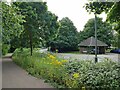
Introduction
This page details the photographs taken nearby to Garth Close, SN14 6XF by members of the Geograph project.
The Geograph project started in 2005 with the aim of publishing, organising and preserving representative images for every square kilometre of Great Britain, Ireland and the Isle of Man.

There are currently over 7.5m images from over14,400 individuals and you can help contribute to the project by visiting https://www.geograph.org.uk
Image Map
Images are licensed for reuse under creativecommons.org/licenses/by-sa/2.0
Notes
- Clicking on the map will re-center to the selected point.
- The higher the marker number, the further away the image location is from the centre of the postcode.
Image Listing (20 Images Found)
Images are licensed for reuse under creativecommons.org/licenses/by-sa/2.0
Image
Details
Distance
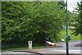
1
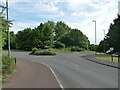
Roundabout on Stainers Way
Where Barnes Road goes off to the left.
Image: © Stephen Craven
Taken: 13 Jul 2022
0.04 miles
2
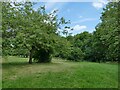
Open space off Stainers Way
When this housing estate at Hardenhuish was built, a generous amount of green space was left between areas of housing.
Image: © Stephen Craven
Taken: 13 Jul 2022
0.08 miles
3
Celandine Way
1990s houses in Upper Farm.
Image: © Burgess Von Thunen
Taken: 16 Oct 2011
0.10 miles
4
Sorrel Close
1980s houses in Upper Farm.
Image: © Burgess Von Thunen
Taken: 16 Oct 2011
0.11 miles
5
Stainers Way with cycle path
A segregated cycle path runs right through this housing estate, sometimes next to Stainers Way, sometimes diverging from it.
Image: © Stephen Craven
Taken: 13 Jul 2022
0.11 miles
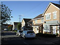
6
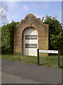
Barnes Road, Chippenham
This new development in the Hardenhuish area has a somewhat ornate sign to denote it.
Image: © Neil Owen
Taken: 29 Feb 2012
0.12 miles
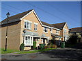
7
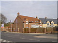
A new addition
Some recently built properties opposite Barnes Road.
Image: © Neil Owen
Taken: 29 Feb 2012
0.14 miles
8

Tomb of 19th century economist David Ricardo
Stands by the south-east corner of Hardenhuish Church.
Image: © tristan forward
Taken: 21 Feb 2009
0.16 miles
9
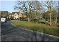
2010 : Sandown Drive, Chippenham
A modern housing estate west of Chippenham, handy for the A420 and the western bypass.
Image: © Maurice Pullin
Taken: 16 Mar 2010
0.16 miles
10
Chippenham : Stainer's Way
A roundabout on Stainer's Way.
Image: © Lewis Clarke
Taken: 30 May 2017
0.16 miles