IMAGES TAKEN NEAR TO
Moss Mead, CHIPPENHAM, SN14 0TN

Introduction

This page details the photographs taken nearby to Moss Mead, SN14 0TN by members of the Geograph project.

The Geograph project started in 2005 with the aim of publishing, organising and preserving representative images for every square kilometre of Great Britain, Ireland and the Isle of Man.

There are currently over 7.5m images from over14,400 individuals and you can help contribute to the project by visiting https://www.geograph.org.uk

Image Map


Images are licensed for reuse under creativecommons.org/licenses/by-sa/2.0
Notes
  • Clicking on the map will re-center to the selected point.
  • The higher the marker number, the further away the image location is from the centre of the postcode.

Image Listing (6 Images Found)

Images are licensed for reuse under creativecommons.org/licenses/by-sa/2.0
Image
Details
Distance
1
Vincients Wood
Near the entrance to the nature reserve.
Image: © Wayland Smith Taken: 8 Mar 2020
0.07 miles
2
2010 : Concrete footbridge over the Chippenham Bypass
Also used as a cycleway. Connects a business park with fields to the west of the bypass.
Image: © Maurice Pullin Taken: 16 Mar 2010
0.10 miles
3
2010 : Dirty street lamp on the Chippenham bypass
Looking south on the A350. Did not jump up to get it, was taken from a footbridge. The lump on top is a light sensor.
Image: © Maurice Pullin Taken: 16 Mar 2010
0.12 miles
4
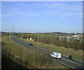
Chippenham Bypass with pylons
One of the few bypasses that is shorter than the through route!
Image: © Peter Watkins Taken: 29 Jan 2006
0.13 miles
5
2010 : Electricity pylon west of Chippenham
Near Frogwell. Taken from a footbridge/cycleway crossing the Chippenham bypass. If you can't beat 'em join 'em. I'm so old I can remember Chippenham before it was surrounded by a forest of pylons.
Image: © Maurice Pullin Taken: 16 Mar 2010
0.22 miles
6
2010 : A350 Chippenham bypass
Heading north, the junction with the A420 is about half a mile ahead. A fairly large business park is on the other side of the road.
Image: © Maurice Pullin Taken: 16 Mar 2010
0.23 miles