IMAGES TAKEN NEAR TO
Wheatfield Avenue, CHIPPENHAM, SN14 0FX
Introduction
This page details the photographs taken nearby to Wheatfield Avenue, SN14 0FX by members of the Geograph project.
The Geograph project started in 2005 with the aim of publishing, organising and preserving representative images for every square kilometre of Great Britain, Ireland and the Isle of Man.

There are currently over 7.5m images from over14,400 individuals and you can help contribute to the project by visiting https://www.geograph.org.uk
Image Map
Images are licensed for reuse under creativecommons.org/licenses/by-sa/2.0
Notes
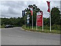
- Clicking on the map will re-center to the selected point.
- The higher the marker number, the further away the image location is from the centre of the postcode.
Image Listing (15 Images Found)
Images are licensed for reuse under creativecommons.org/licenses/by-sa/2.0
Image
Details
Distance
2
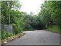
Easton Lane
Turning off Salterford Lane, Easton Lane is carried over the A350 on a bridge as it heads toward the village of Easton.
Image: © Michael Dibb
Taken: 22 Apr 2017
0.12 miles
3
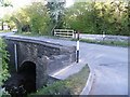
Over the brook
The bridge carries Salterford Lane, B4528, over the wonderfully named Pudding Brook. The brook flows into the River Avon.
Image: © Michael Dibb
Taken: 22 Apr 2017
0.15 miles
4
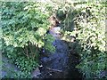
Gently flow the brook
Seen from the bridge carrying Salterford Lane, B4528, over the wonderfully named Pudding Brook. The brook flows into the River Avon.
Image: © Michael Dibb
Taken: 22 Apr 2017
0.16 miles
5
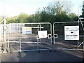
Refurbishment in progress
The way into this large depot has been blocked off whilst a refurbishment scheme is in progress. The depot is just off Salterford Lane.
Image: © Michael Dibb
Taken: 22 Apr 2017
0.16 miles
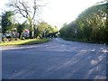
7
Salterford Lane
A view looking south along Saltersford Lane towards the traffic lights controlling the traffic through the single lane section of road under the high arch railway bridge on the left of the image.
Image: © Phil Williams
Taken: 27 Jun 2006
0.18 miles
9
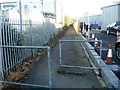
The way to the park
The footpath links the Methuen Park roundabout on the A4 with the road and the business park of the same name.
Image: © Michael Dibb
Taken: 22 Apr 2017
0.20 miles
10
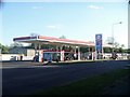
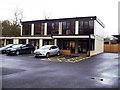
A4 filling station
This Esso filling station is on Bath Road, the A4. Their unleaded petrol was 1.5p per litre more expensive than the Sainsbury's filling station, a couple of hundred yards along the road.
Image: © Michael Dibb
Taken: 22 Apr 2017
0.21 miles